Latitude: 51.7845 / 51°47'4"N
Longitude: -1.4766 / 1°28'35"W
OS Eastings: 436199
OS Northings: 209670
OS Grid: SP361096
Mapcode National: GBR 6VS.5GP
Mapcode Global: VHC02.CD7T
Plus Code: 9C3WQGMF+R9
Entry Name: Stables and Attached Mounting Block, Wall and Traphouse Approximately 20 Metres North of Manor Farmhouse
Listing Date: 3 March 1988
Grade: II
Source: Historic England
Source ID: 1212325
English Heritage Legacy ID: 252639
ID on this website: 101212325
Location: Cogges, West Oxfordshire, OX28
County: Oxfordshire
District: West Oxfordshire
Civil Parish: Witney
Built-Up Area: Witney
Traditional County: Oxfordshire
Lieutenancy Area (Ceremonial County): Oxfordshire
Church of England Parish: Cogges
Church of England Diocese: Oxford
Tagged with: Stable
WITNEY COGGES SP3609 8/85 Stables and attached mounting block, wall and traphouse approx, 20m. N of Manor Farmhouse GV II
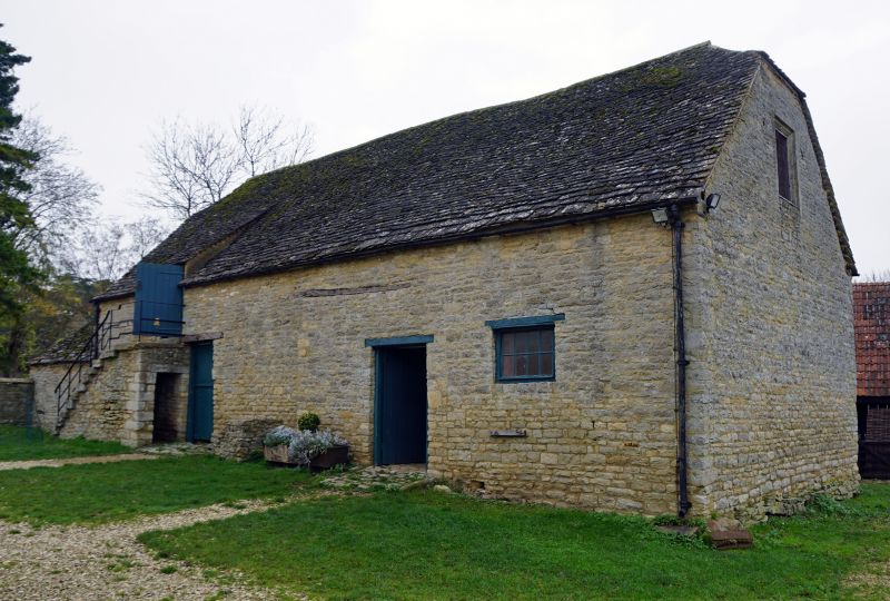
Stables, now part of Cogges Farm Museum. C17, remodelled mid C18. Coursed limestone rubble; hipped stone slate roof. 2-unit plan. One storey and loft. Timber lintels over 2 blocked openings, and two C20 doors. Mounting block of 3 steps; straight-flight of stone steps to C20 loft door. Interior: working-horse stable to left: stop-chamfered beans; wooden mangers, racks and chaff box against end walls; harness pegs. Hackney-horse stable to right, open to roof, has mid C19 stalls with mangers, and loose stabling for 2 horses with mangers and trough. 6-bay collar-truss roof, with butt purlins. Subsidiary features: limestone rubble wall with ashlar coping projects approximately 11 metres to front of front left corner. Early C19 traphouse, to left, of similar materials with hipped one-bay roof.
Listing NGR: SP3620509670
External links are from the relevant listing authority and, where applicable, Wikidata. Wikidata IDs may be related buildings as well as this specific building. If you want to add or update a link, you will need to do so by editing the Wikidata entry.


Other nearby listed buildings