Latitude: 51.7843 / 51°47'3"N
Longitude: -1.4866 / 1°29'11"W
OS Eastings: 435509
OS Northings: 209643
OS Grid: SP355096
Mapcode National: GBR 6VS.2Z3
Mapcode Global: VHC02.5DYZ
Plus Code: 9C3WQGM7+P8
Entry Name: Congregational Meeting House
Listing Date: 22 September 1975
Grade: II
Source: Historic England
Source ID: 1213452
English Heritage Legacy ID: 398056
ID on this website: 101213452
Location: Witney, West Oxfordshire, OX28
County: Oxfordshire
District: West Oxfordshire
Civil Parish: Witney
Built-Up Area: Witney
Traditional County: Oxfordshire
Lieutenancy Area (Ceremonial County): Oxfordshire
Church of England Parish: Witney
Church of England Diocese: Oxford
Tagged with: House
WITNEY MEETING HOUSE LANE SP3509N (North side) 10/201 Congregational Meeting House 22/09/75 - II
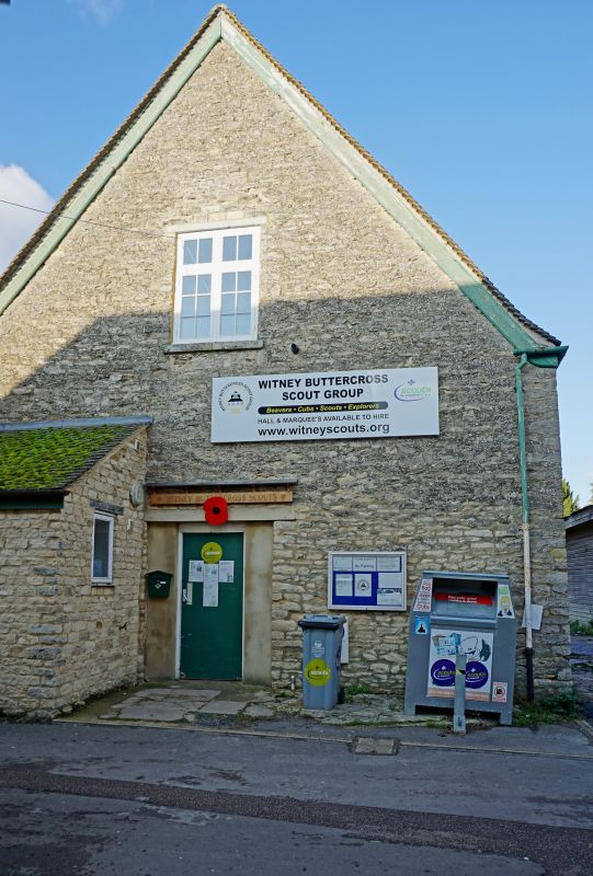
Congregational meeting house, now Scout hut. Early C18. Coursed limestone rubble; gabled concrete tile roof. Single-cell plan. One store and loft gable end, facing lane, has timber lintel over loft opening above concrete linial over C20 double doors. Right side wall, of 2-window range has timber lintels over early C18 wood-mullioned and transomed cross windows. Rear outshut has Welsh slate roof. (National Monuments Record).
Listing NGR: SP3550909643
External links are from the relevant listing authority and, where applicable, Wikidata. Wikidata IDs may be related buildings as well as this specific building. If you want to add or update a link, you will need to do so by editing the Wikidata entry.


Other nearby listed buildings