Approximate Location Map
Large Map »
Latitude: 51.4853 / 51°29'6"N
Longitude: 0.0028 / 0°0'10"E
OS Eastings: 539159
OS Northings: 178157
OS Grid: TQ391781
Mapcode National: GBR L1.5CS
Mapcode Global: VHHNJ.0XBS
Plus Code: 9F32F2P3+44
Entry Name: 142, Old Woolwich Road
Listing Date: 21 July 1993
Grade: II
Source: Historic England
Source ID: 1214182
English Heritage Legacy ID: 398931
ID on this website: 101214182
Location: Greenwich, London, SE10
County: London
District: Greenwich
Electoral Ward/Division: Peninsula
Parish: Non Civil Parish
Built-Up Area: Greenwich
Traditional County: Kent
Lieutenancy Area (Ceremonial County): Greater London
Church of England Parish: East Greenwich Christ Church, St Andrew and St Michael
Church of England Diocese: Southwark
Tagged with: Building
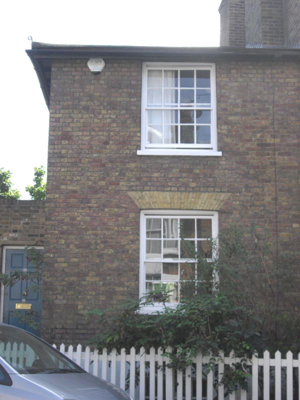
TQ 3978 OLD WOOLWICH ROAD
786-1/16/10007 No 142
GV II
House, c1820-30. Brown brick with hipped slate roof 3 storeys - 1 window. 12-pane sash,
cambered to ground floor. Set-back entrance to left with 6-panelled door.
Listing NGR: TQ3915978154
External links are from the relevant listing authority and, where applicable, Wikidata. Wikidata IDs may be related buildings as well as this specific building. If you want to add or update a link, you will need to do so by editing the Wikidata entry.


Other nearby listed buildings
