Latitude: 54.2644 / 54°15'51"N
Longitude: -0.8235 / 0°49'24"W
OS Eastings: 476724
OS Northings: 486049
OS Grid: SE767860
Mapcode National: GBR QMP4.H3
Mapcode Global: WHF9W.B22P
Plus Code: 9C6X757G+PH
Entry Name: Croft Head Farmhouse and Attached Railings at Rear
Listing Date: 27 August 1987
Grade: II
Source: Historic England
Source ID: 1214386
English Heritage Legacy ID: 382526
ID on this website: 101214386
Location: Wrelton, North Yorkshire, YO18
County: North Yorkshire
District: Ryedale
Civil Parish: Wrelton
Traditional County: Yorkshire
Lieutenancy Area (Ceremonial County): North Yorkshire
Church of England Parish: Middleton St Andrew
Church of England Diocese: York
Tagged with: Farmhouse
WRELTON THE VILLAGE SE 7686-7786 (south side) 17/108 Croft Head Farmhouse and attached railings at rear GV II
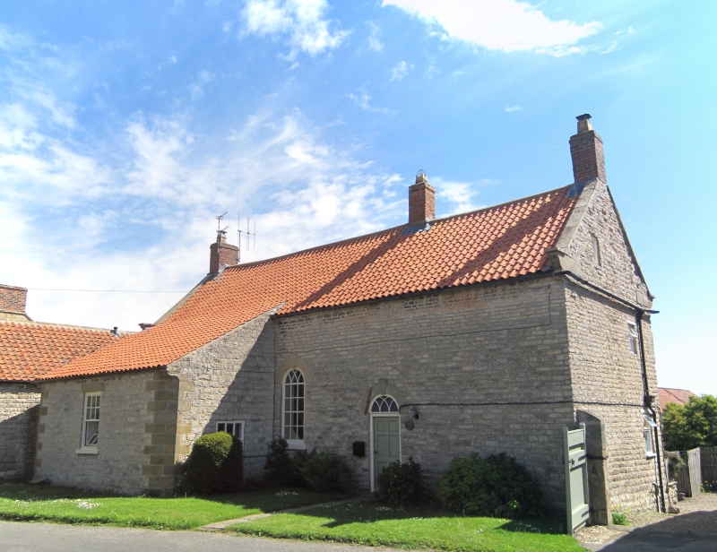
Farmhouse. Early C19. Squared limestone with sandstone ashlar quoins, dressings and eaves course; pantile roof with brick stacks. 2-storey, 3-window front. Centre left board door beneath blind patterned fanlight. Windows throughout are 16-pane sashes with painted stone sills. All openings have tripartite lintels with triple keyblocks. Coped gables and shaped kneelers. End and left-of-centre stacks. Rear (on street): 6-panel door, with Gothick-glazed overlight, to right of round-headed Gothick-glazed window, both beneath keyed rounded archivolts. Single-storey outshut at left with 12-pane sash. The quoined corners of the outshut are canted and finished with coved corbels at eaves level. Interior. Beaded joists throughout ground floor. Room to left contains a fine triple-arched hearth with a Wrelton range. In room to right of door, the original fireplace surround, with fluted jambs and corner roundels, is detectable behind a later fireplace. Railings. Square-section railings with urn finials, raised on a chamfered plinth, partly enclose a small garden. On south side the railings span a massive square waterbutt of tooled stone, set beneath them, in which run-off water from the range of farmbuildings (qv) is collected.
Listing NGR: SE7672486049
External links are from the relevant listing authority and, where applicable, Wikidata. Wikidata IDs may be related buildings as well as this specific building. If you want to add or update a link, you will need to do so by editing the Wikidata entry.


Other nearby listed buildings