Approximate Location Map
Large Map »
Latitude: 53.6455 / 53°38'43"N
Longitude: -1.7794 / 1°46'45"W
OS Eastings: 414678
OS Northings: 416573
OS Grid: SE146165
Mapcode National: GBR JV08.KY
Mapcode Global: WHCB1.MMVP
Plus Code: 9C5WJ6WC+56
Entry Name: 46, King Street
Listing Date: 29 September 1978
Grade: II
Source: Historic England
Source ID: 1214568
English Heritage Legacy ID: 340068
ID on this website: 101214568
Location: Huddersfield, Kirklees, West Yorkshire, HD1
County: Kirklees
Electoral Ward/Division: Newsome
Parish: Non Civil Parish
Built-Up Area: Huddersfield
Traditional County: Yorkshire
Lieutenancy Area (Ceremonial County): West Yorkshire
Church of England Parish: Huddersfield St Peter
Church of England Diocese: Leeds
Tagged with: Building
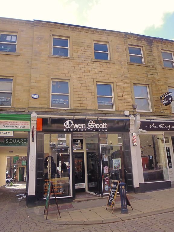
KING STREET
1.
5113 (South Side)
No 46
SE 1416 NE 2/742
II GV
2.
Early C19. Ashlar. Pitched stone slate roof. 3 storeys. Stone brackets
to gutter. Continuous sill band on 1st floor. 2 ranges of sashes. Mid C19
shopfront with panelled pilasters and moulded consoles. Rear elevation red
brick: 1 range of sashes with glazing bars.
Listing NGR: SE1467816573
External links are from the relevant listing authority and, where applicable, Wikidata. Wikidata IDs may be related buildings as well as this specific building. If you want to add or update a link, you will need to do so by editing the Wikidata entry.


Other nearby listed buildings
