Latitude: 52.2842 / 52°17'3"N
Longitude: -2.0596 / 2°3'34"W
OS Eastings: 396032
OS Northings: 265117
OS Grid: SO960651
Mapcode National: GBR 2GJ.N4B
Mapcode Global: VH9ZS.8V1B
Plus Code: 9C4V7WMR+M5
Entry Name: Piper's Hill Farmhouse and Railings with Wall to Front
Listing Date: 26 June 1985
Grade: II
Source: Historic England
Source ID: 1215109
English Heritage Legacy ID: 400146
ID on this website: 101215109
Location: Sharpway Gate, Wychavon, Worcestershire, B60
County: Worcestershire
District: Wychavon
Civil Parish: Dodderhill
Traditional County: Worcestershire
Lieutenancy Area (Ceremonial County): Worcestershire
Church of England Parish: Stoke Prior, Wychbold and Upton Warren
Church of England Diocese: Worcester
Tagged with: Farmhouse
DODDERHILL CP PIPER'S HILL SO 96 NE 7/20 Piper's Hill Farmhouse and railings with wall to front
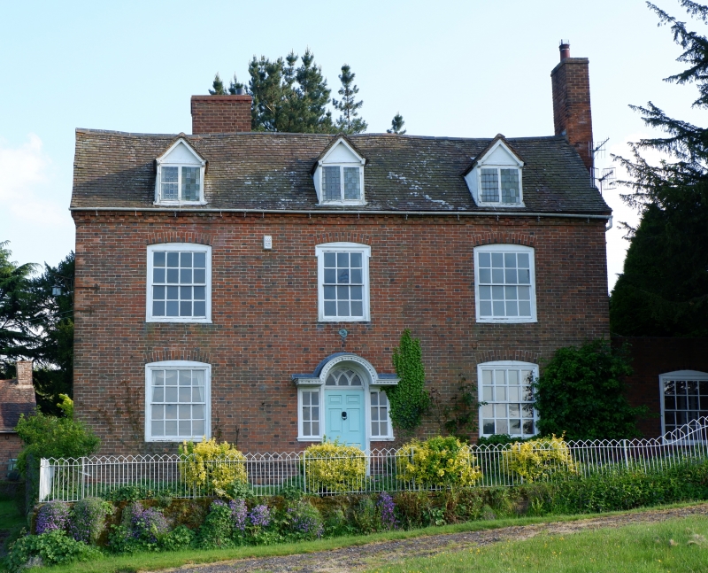
- II Farmhouse and railings. Early C18, remodelled early C19. Brick, machine tile roof, gable end stack to right. Two storeys and attic lit by three gabled dormers; dentilled brick cornice; three windows: segmental-headed flush framed glazing bar sashes, outer 16-pane, central window with eared architrave; ground floor: two 16-pane flush framed sashes flank central entrance, flat canopy over entrance with moulded cornice and segmental ped- iment, door flanked by 6-pane fixed casements, Gothick glazed fanlight, 6-panelled door. The wrought iron railings are Gothick style on a low brick wall, gate to right with cast iron piers, early C19. Interior not inspected.
Listing NGR: SO9603265117
External links are from the relevant listing authority and, where applicable, Wikidata. Wikidata IDs may be related buildings as well as this specific building. If you want to add or update a link, you will need to do so by editing the Wikidata entry.


Other nearby listed buildings