Approximate Location Map
Large Map »
Latitude: 51.4378 / 51°26'16"N
Longitude: -1.0742 / 1°4'26"W
OS Eastings: 464450
OS Northings: 171382
OS Grid: SU644713
Mapcode National: GBR B4C.Z2Q
Mapcode Global: VHCZH.B4H4
Plus Code: 9C3WCWQG+48
Entry Name: 50, High Street
Listing Date: 19 June 1984
Grade: II
Source: Historic England
Source ID: 1215214
English Heritage Legacy ID: 400279
ID on this website: 101215214
Location: Theale, West Berkshire, RG7
County: West Berkshire
Civil Parish: Theale
Built-Up Area: Theale
Traditional County: Berkshire
Lieutenancy Area (Ceremonial County): Berkshire
Church of England Parish: Theale
Church of England Diocese: Oxford
Tagged with: Building
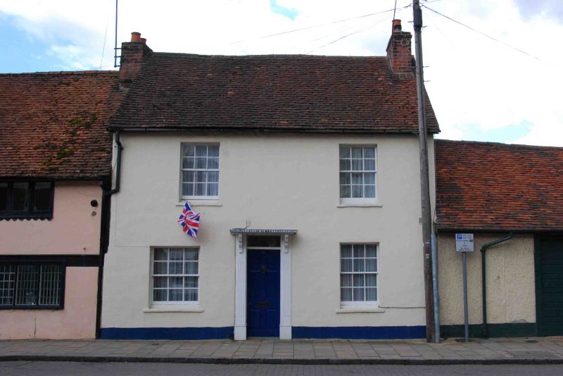
SU 6471 THEALE HIGH STREET (south side)
7/22 No. 50
G.V. II
House. Late C18. Rendered with old tile roof. 2 storeys. End stack to right.
2 glazing bar sashes on each floor. Central 6-panelled door with rectangular
overlight, reeded architrave and shaped brackets supporting flat hood.
Listing NGR: SU6445071382
External links are from the relevant listing authority and, where applicable, Wikidata. Wikidata IDs may be related buildings as well as this specific building. If you want to add or update a link, you will need to do so by editing the Wikidata entry.


Other nearby listed buildings
