Approximate Location Map
Large Map »
Latitude: 51.5148 / 51°30'53"N
Longitude: -2.4358 / 2°26'9"W
OS Eastings: 369852
OS Northings: 179633
OS Grid: ST698796
Mapcode National: GBR JY.HV94
Mapcode Global: VH88J.Q6M2
Plus Code: 9C3VGH77+WM
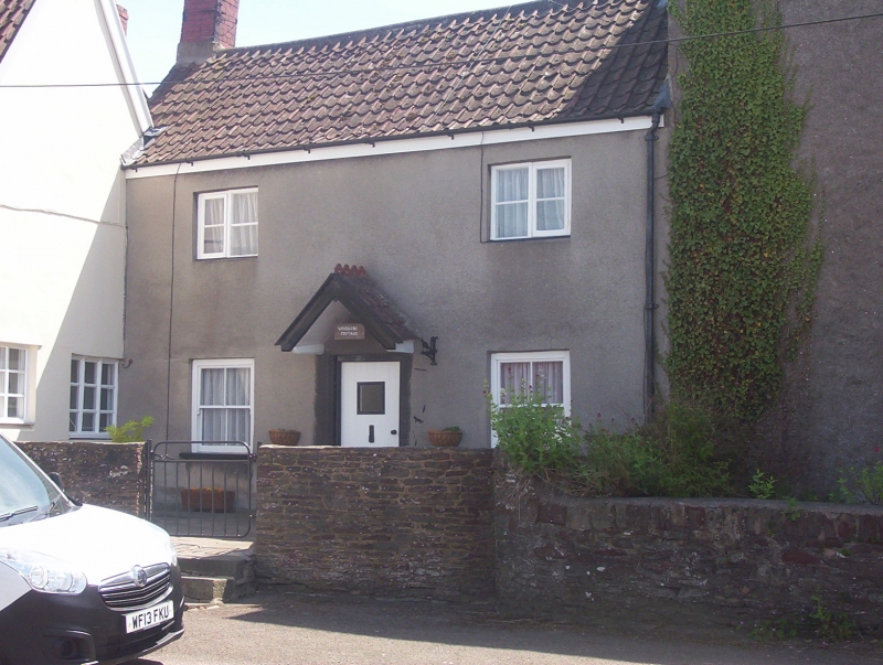
Entry Name: Woodbine Cottage
Listing Date: 15 August 1985
Grade: II
Source: Historic England
Source ID: 1215564
English Heritage Legacy ID: 400827
ID on this website: 101215564
Location: Westerleigh, South Gloucestershire, BS37
County: South Gloucestershire
Civil Parish: Westerleigh
Built-Up Area: Westerleigh
Traditional County: Gloucestershire
Lieutenancy Area (Ceremonial County): Gloucestershire
Church of England Parish: Yate
Church of England Diocese: Bristol
Tagged with: Cottage
ST 67 NE WESTERLEIGH C.P. CHURCH ROAD (south side)
4/338 Woodbine Cottage
G.V.
II
House. C17 with C19 alterations. Rubble, roughcast, pantiled roof with brick
gable stacks. 2 storeys and 2 windows, ground floor has two 4-pane sashes,
central door with triangular hood, first floor has two 2-light casements of 2 panes
each. Interior: not inspected.
Listing NGR: ST6985279633
External links are from the relevant listing authority and, where applicable, Wikidata. Wikidata IDs may be related buildings as well as this specific building. If you want to add or update a link, you will need to do so by editing the Wikidata entry.


Other nearby listed buildings
