Approximate Location Map
Large Map »
Latitude: 53.622 / 53°37'19"N
Longitude: -1.7592 / 1°45'33"W
OS Eastings: 416021
OS Northings: 413969
OS Grid: SE160139
Mapcode National: GBR JV4K.XB
Mapcode Global: WHCB7.Y7F4
Plus Code: 9C5WJ6CR+R8
Entry Name: Clay Hall
Listing Date: 29 September 1978
Grade: II
Source: Historic England
Source ID: 1215624
English Heritage Legacy ID: 340196
ID on this website: 101215624
Location: The Lumb, Kirklees, West Yorkshire, HD4
County: Kirklees
Electoral Ward/Division: Almondbury
Parish: Non Civil Parish
Built-Up Area: Huddersfield
Traditional County: Yorkshire
Lieutenancy Area (Ceremonial County): West Yorkshire
Church of England Parish: Almondbury with Farnley Tyas Team Parish
Church of England Diocese: Leeds
Tagged with: House
LUMB LANE
1.
5113
(North Side)
Almondbury
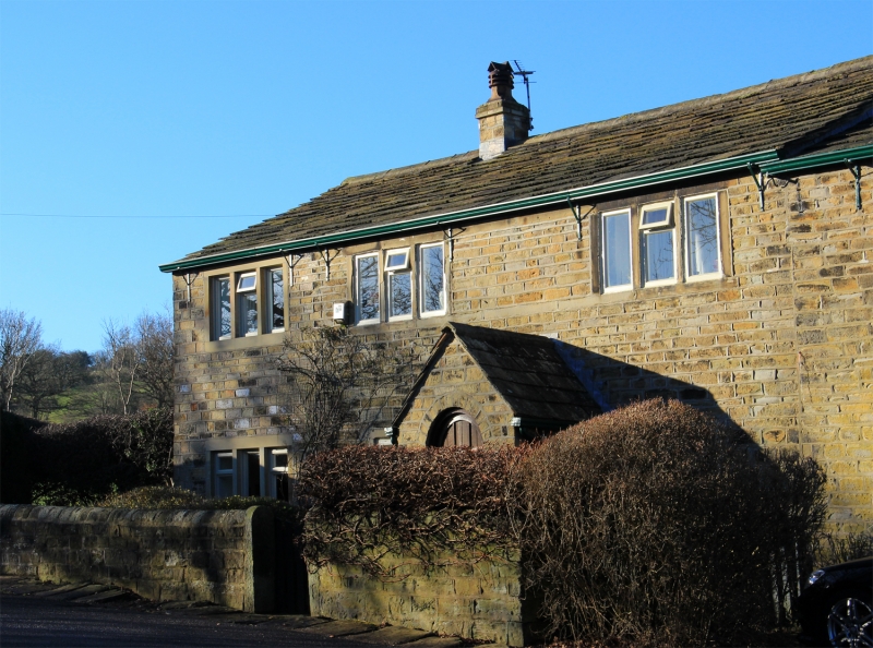
No 58 (Clay Hall)
SE 1613 49/873
II
2.
C19. Longhouse type farmhouse. Hammer-dressed stone. Pitched stone slate roof. 2 storeys. 2 ranges of 3-light stone mullioned windows. Barn with segment-headed arch and planked doors.
Listing NGR: SE1602113969
External links are from the relevant listing authority and, where applicable, Wikidata. Wikidata IDs may be related buildings as well as this specific building. If you want to add or update a link, you will need to do so by editing the Wikidata entry.


Other nearby listed buildings
