Approximate Location Map
Large Map »
Latitude: 50.7315 / 50°43'53"N
Longitude: -1.1604 / 1°9'37"W
OS Eastings: 459349
OS Northings: 92765
OS Grid: SZ593927
Mapcode National: GBR 9CN.1FG
Mapcode Global: FRA 87G4.MS3
Plus Code: 9C2WPRJQ+HR
Entry Name: Waldron House
Listing Date: 18 May 1972
Grade: II
Source: Historic England
Source ID: 1216711
English Heritage Legacy ID: 411359
ID on this website: 101216711
Location: Ryde, Isle of Wight, PO33
County: Isle of Wight
Civil Parish: Ryde
Built-Up Area: Ryde
Traditional County: Hampshire
Lieutenancy Area (Ceremonial County): Isle of Wight
Church of England Parish: Ryde
Church of England Diocese: Portsmouth
Tagged with: House
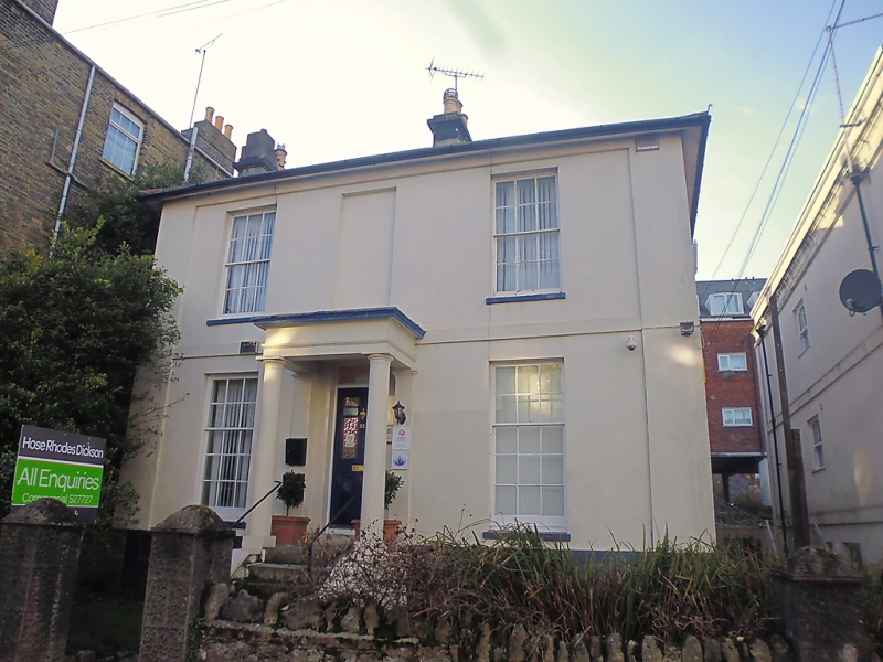
GEORGE STREET
1.
1577
(West Side)
No 22
(Waldron House)
SZ 5992 2/32
II
2.
Plain detached house of about 1830. Two storeys and semi-basement. Two
windows stuccoed. Pilasters flanking the front. Stringcourse. Eaves
cornice. Hipped slate roof. Glazing bars intact. Porch up five steps.
Doorway with rectangular fanlight.
Listing NGR: SZ5934992765
External links are from the relevant listing authority and, where applicable, Wikidata. Wikidata IDs may be related buildings as well as this specific building. If you want to add or update a link, you will need to do so by editing the Wikidata entry.


Other nearby listed buildings
