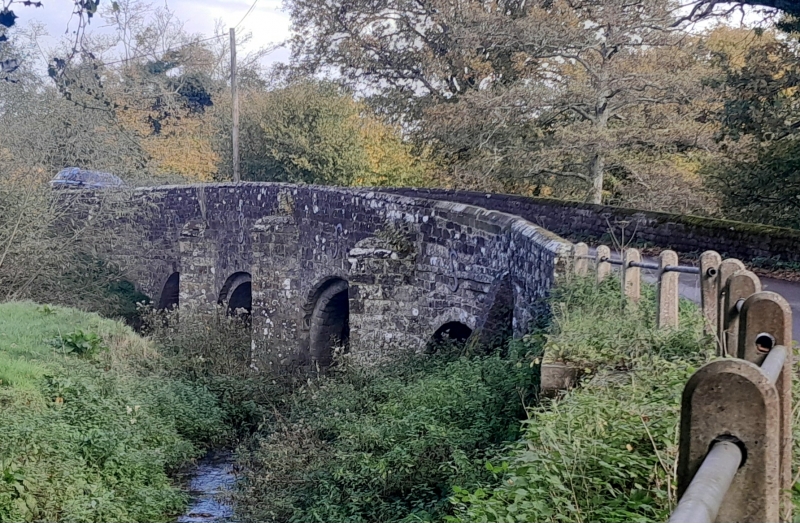
Latitude: 51.0037 / 51°0'13"N
Longitude: -0.886 / 0°53'9"W
OS Eastings: 478262
OS Northings: 123290
OS Grid: SU782232
Mapcode National: GBR CC5.YNM
Mapcode Global: FRA 961G.DP0
Plus Code: 9C3X2437+FJ
Entry Name: Durford Bridge
Listing Date: 18 June 1959
Grade: II
Source: Historic England
Source ID: 1217009
English Heritage Legacy ID: 411740
ID on this website: 101217009
Location: Durleighmarsh, Chichester, West Sussex, GU31
County: West Sussex
District: Chichester
Civil Parish: Harting
Traditional County: Sussex
Lieutenancy Area (Ceremonial County): West Sussex
Church of England Parish: Rogate St Bartholomew with Terwick St Peter
Church of England Diocese: Chichester
ROGATE HARTING ROAD SU 72 9/17 Durford Bridge 18.6.59 - II
Bridge. 1600 circa, restored in 1924. Stone. Four semi-circular arches with three broad square ribs and extra chamfered order to the middle bays on the east side. V-shaped cutwaters on both sides. Scheduled Ancient Monument.
Listing NGR: SU7826223290


Other nearby listed buildings