Approximate Location Map
Large Map »
Latitude: 51.0082 / 51°0'29"N
Longitude: -0.851 / 0°51'3"W
OS Eastings: 480709
OS Northings: 123825
OS Grid: SU807238
Mapcode National: GBR CC7.MPM
Mapcode Global: FRA 963G.295
Plus Code: 9C3X245X+7J
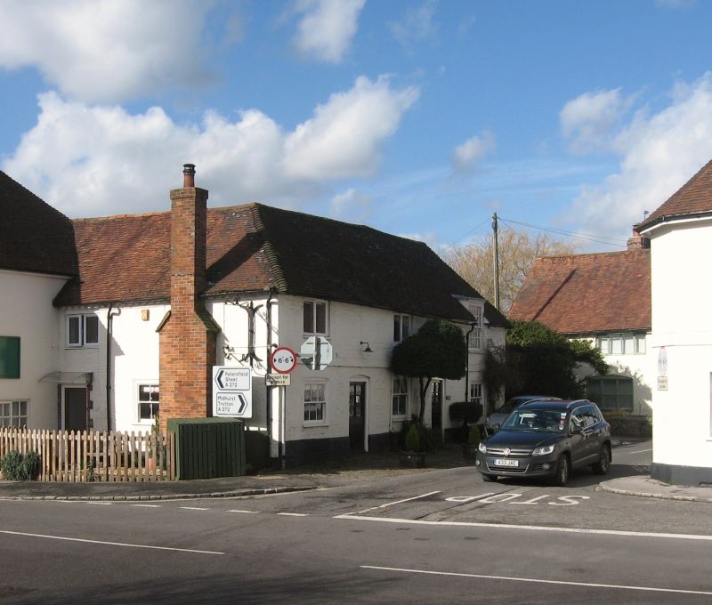
Entry Name: The Wyndham Arms Inn
Listing Date: 26 November 1987
Grade: II
Source: Historic England
Source ID: 1217096
English Heritage Legacy ID: 411846
ID on this website: 101217096
Location: Rogate, Chichester, West Sussex, GU31
County: West Sussex
District: Chichester
Civil Parish: Rogate
Traditional County: Sussex
Lieutenancy Area (Ceremonial County): West Sussex
Church of England Parish: Rogate St Bartholomew with Terwick St Peter
Church of England Diocese: Chichester
Tagged with: Inn
ROGATE NORTH STREET (west side)
SU 8023-8123
20/3 The Wyndham Arms Inn
-
GV II
Public house. C18 front to an older building. Stone, white washed. String-
course. Hipped tiled roof. Some casement windows, some sashes without glazing
bars. Two storeys. Three windows.
Listing NGR: SU8070923825
External links are from the relevant listing authority and, where applicable, Wikidata. Wikidata IDs may be related buildings as well as this specific building. If you want to add or update a link, you will need to do so by editing the Wikidata entry.


Other nearby listed buildings
