Latitude: 51.0086 / 51°0'30"N
Longitude: -0.8512 / 0°51'4"W
OS Eastings: 480696
OS Northings: 123869
OS Grid: SU806238
Mapcode National: GBR CC7.MND
Mapcode Global: FRA 963G.26S
Plus Code: 9C3X245X+CG
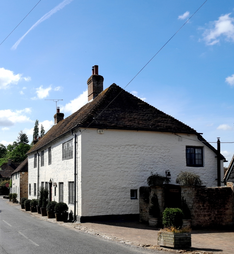
Entry Name: The White House
Listing Date: 26 November 1987
Grade: II
Source: Historic England
Source ID: 1217133
English Heritage Legacy ID: 411848
ID on this website: 101217133
Location: Rogate, Chichester, West Sussex, GU31
County: West Sussex
District: Chichester
Civil Parish: Rogate
Traditional County: Sussex
Lieutenancy Area (Ceremonial County): West Sussex
Church of England Parish: Rogate St Bartholomew with Terwick St Peter
Church of England Diocese: Chichester
Tagged with: House
ROGATE NORTH STREET (west side) SU 8023-8123 20/5 The White House - GV II
Once several cottages, now one house. C18. Stone front, white washed. Modillion eaves cornice. Tiled roof, hipped at north end. Casement windows. Two storeys. Six windows.
Listing NGR: SU8069623869
External links are from the relevant listing authority and, where applicable, Wikidata. Wikidata IDs may be related buildings as well as this specific building. If you want to add or update a link, you will need to do so by editing the Wikidata entry.


Other nearby listed buildings