Latitude: 50.9881 / 50°59'17"N
Longitude: 0.607 / 0°36'25"E
OS Eastings: 583066
OS Northings: 124205
OS Grid: TQ830242
Mapcode National: GBR QWY.XZT
Mapcode Global: FRA D65H.L92
Plus Code: 9F22XJQ4+7Q
Entry Name: The Wilderness
Listing Date: 3 August 1961
Grade: II
Source: Historic England
Source ID: 1217108
English Heritage Legacy ID: 411870
ID on this website: 101217108
Location: Northiam, Rother, East Sussex, TN31
County: East Sussex
District: Rother
Civil Parish: Northiam
Built-Up Area: Northiam
Traditional County: Sussex
Lieutenancy Area (Ceremonial County): East Sussex
Church of England Parish: Northiam St Mary
Church of England Diocese: Chichester
Tagged with: Architectural structure
TQ 8224-8324 NORTHIAM RYE ROAD
47/52 The Wilderness
3.8.61
GV II
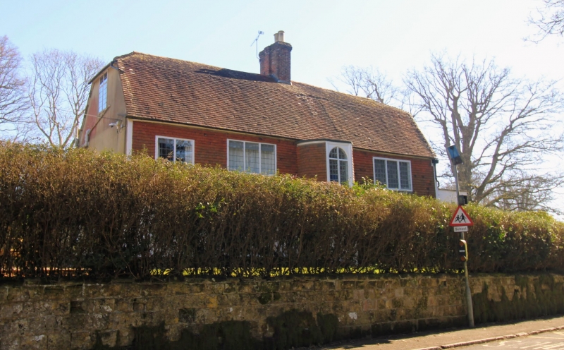
C17. Two storeys. Four windows. Ground floor roughcast, above tile-hung and painted. Half-hipped and mansarded tiled roof. Central projection of two storeys with curved sides. Casement windows with small square panes.
Listing NGR: TQ8306624205
External links are from the relevant listing authority and, where applicable, Wikidata. Wikidata IDs may be related buildings as well as this specific building. If you want to add or update a link, you will need to do so by editing the Wikidata entry.


Other nearby listed buildings