Approximate Location Map
Large Map »
Latitude: 53.6278 / 53°37'40"N
Longitude: -1.8577 / 1°51'27"W
OS Eastings: 409509
OS Northings: 414593
OS Grid: SE095145
Mapcode National: GBR HVGH.M8
Mapcode Global: WHCB6.F2MP
Plus Code: 9C5WJ4HR+4W
Entry Name: Offices and Workshop Range at Westwood Mills
Listing Date: 11 July 1985
Last Amended: 20 June 2000
Grade: II*
Source: Historic England
Source ID: 1217132
English Heritage Legacy ID: 411685
ID on this website: 101217132
Location: Linthwaite, Kirklees, West Yorkshire, HD7
County: Kirklees
Electoral Ward/Division: Colne Valley
Parish: Non Civil Parish
Traditional County: Yorkshire
Lieutenancy Area (Ceremonial County): West Yorkshire
Church of England Parish: Golcar St John the Evangelist
Church of England Diocese: Leeds
Tagged with: Office building
SE 01 SE
391/5/274
11-JUL-85
COLNE VALLEY
LOWESTWOOD LANE
LINTHWAITE
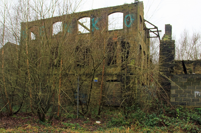
Offices and Workshop Range at Westwood Mills
(Formerly listed as:
LOWESTWOOD LANE
LINTHWAITE
House at Westwood Mill)
GV
II*
Office and workshop range. Early C19, with some later alterations. Coursed hammer-dressed gritstone, stone roof slates largely removed. 2 storeys, 3 bays survive and there are the remains of a 4th bay at the north end. All openings now blocked.
East elevation: second entrance bay has plain stone surround with tie-stone jambs; 2- and 3-light windows with flat-faced mullions, those to ground floor left removed. The fourth bay survives as a screen wall with a 2-light window blocked with stones on the ground floor.
West elevation; to mill yard has blocked doorway and window to ground floor.
South elevation has segmental arch with stone voussoirs, blocked by brickwork, just above ground level right, long tie-stone above; the upper window level and the gable are rendered.
North elevation: gabled rubble walling has remains of plaster indicating that it was an internal wall which was altered when the C20 electricity sub-station was added.
INTERIOR not inspected.
Listing NGR: SE0950914593
External links are from the relevant listing authority and, where applicable, Wikidata. Wikidata IDs may be related buildings as well as this specific building. If you want to add or update a link, you will need to do so by editing the Wikidata entry.


Other nearby listed buildings
