Approximate Location Map
Large Map »
Latitude: 53.6276 / 53°37'39"N
Longitude: -1.8581 / 1°51'29"W
OS Eastings: 409484
OS Northings: 414574
OS Grid: SE094145
Mapcode National: GBR HVGH.JB
Mapcode Global: WHCB6.F2FT
Plus Code: 9C5WJ4HR+2Q
Entry Name: Mill Dam at Westwood Mills
Listing Date: 20 June 2000
Grade: II*
Source: Historic England
Source ID: 1271264
English Heritage Legacy ID: 487128
ID on this website: 101271264
Location: Linthwaite, Kirklees, West Yorkshire, HD7
County: Kirklees
Electoral Ward/Division: Colne Valley
Parish: Non Civil Parish
Traditional County: Yorkshire
Lieutenancy Area (Ceremonial County): West Yorkshire
Church of England Parish: Golcar St John the Evangelist
Church of England Diocese: Leeds
Tagged with: Mill building
SE 01 SE
391/5/10018
20-JUN-00
COLNE VALLEY
LOWESTWOOD LANE
Linthwaite
Mill Dam at Westwood Mills
GV
II*
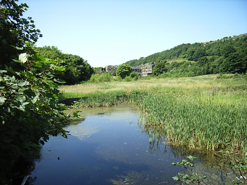
Dam to mill pond. 1801, enlarged 1824 and 1858. Coursed local gritstone. Retaining wall approximately 3 meters high on east face with sluice gates at north to water wheel and at south to overflow. Triangular in plan, tapering to goit from river at west end; approximately 200meters long and 50 meters wide.
The north side of the mill pond is bounded by the towpath of the Huddersfield Canal, a contemporary structure, and the south side is embanked down to the river Colne. This pond also supplied water to the small mill dam at Lower Mill to the south-east now called Titanic Mill.
HISTORY; recorded as the dam embankment, byewash, pentrough and wheel race in a document of 1801 and enlarged in 1824 when a new 2 storey fulling mill was added. The new work included wheel race, wooden and stone pentroughs, dam embankment, two trunks, sluices and byegoits.
Listing NGR: SE0948414574
External links are from the relevant listing authority and, where applicable, Wikidata. Wikidata IDs may be related buildings as well as this specific building. If you want to add or update a link, you will need to do so by editing the Wikidata entry.


Other nearby listed buildings
