Approximate Location Map
Large Map »
Latitude: 51.57 / 51°34'12"N
Longitude: -0.7831 / 0°46'59"W
OS Eastings: 484438
OS Northings: 186383
OS Grid: SU844863
Mapcode National: GBR D5W.DW1
Mapcode Global: VHDWB.CSWT
Plus Code: 9C3XH6C8+2Q
Entry Name: Outbuilding at Town Farm
Listing Date: 31 January 1974
Grade: II
Source: Historic England
Source ID: 1217613
English Heritage Legacy ID: 412770
ID on this website: 101217613
Location: Marlow, Buckinghamshire, SL7
County: Buckinghamshire
Civil Parish: Marlow
Built-Up Area: Marlow
Traditional County: Buckinghamshire
Lieutenancy Area (Ceremonial County): Buckinghamshire
Church of England Parish: Great Marlow with Marlow Bottom, Little Marlow and Bisham
Church of England Diocese: Oxford
Tagged with: Appendage
WEST STREET
1.
1385
(North West Side)
Outbuilding at
Town Farm
SU 8486 2/160A
II
2.
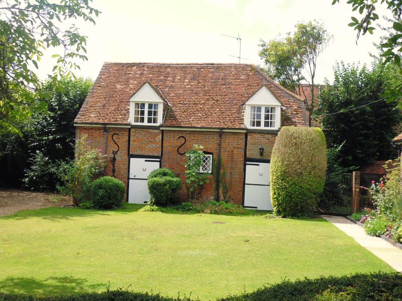
On left a half timbered building, formerly extending further to the south
which has been converted into a modern garage, in such a way as not to
detract from its essential character.
Listing NGR: SU8443886383
External links are from the relevant listing authority and, where applicable, Wikidata. Wikidata IDs may be related buildings as well as this specific building. If you want to add or update a link, you will need to do so by editing the Wikidata entry.


Other nearby listed buildings
