Approximate Location Map
Large Map »
Latitude: 51.2942 / 51°17'39"N
Longitude: 0.4091 / 0°24'32"E
OS Eastings: 568065
OS Northings: 157767
OS Grid: TQ680577
Mapcode National: GBR NPC.VMG
Mapcode Global: VHJM5.1QMQ
Plus Code: 9F327CV5+MJ
Entry Name: Industrial Building to Rear of 71 and 73
Listing Date: 30 November 1993
Grade: II
Source: Historic England
Source ID: 1218175
English Heritage Legacy ID: 392352
ID on this website: 101218175
Location: West Malling, Tonbridge and Malling, Kent, ME19
County: Kent
District: Tonbridge and Malling
Civil Parish: West Malling
Built-Up Area: West Malling
Traditional County: Kent
Lieutenancy Area (Ceremonial County): Kent
Church of England Parish: West Malling St Mary
Church of England Diocese: Rochester
Tagged with: Architectural structure
WEST MALLING
TQ6857 HIGH STREET
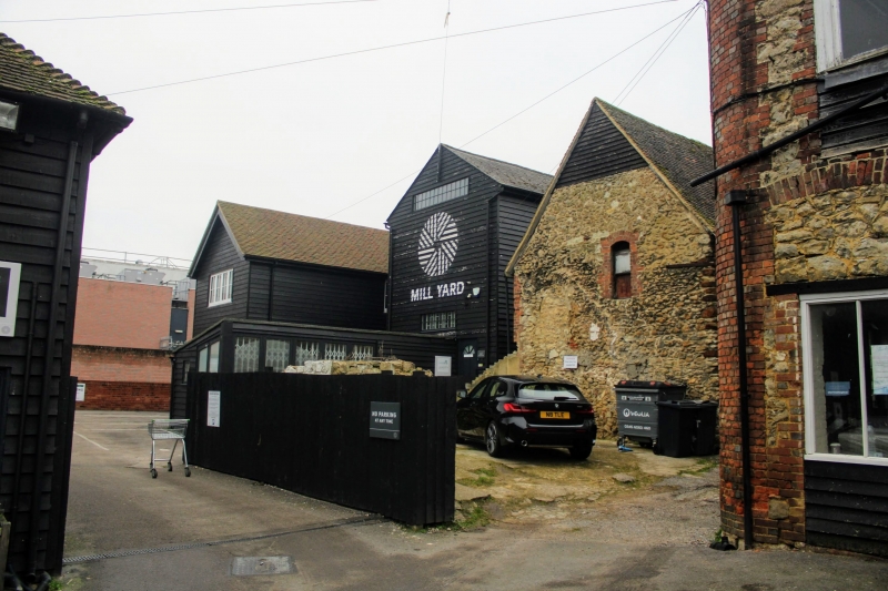
1156-0/3/18 Industrial building to rear of 71
and 73
GV II
Store. Early C19. Weatherboarded building with slate roof. 2
storeys and attics 3 windows. Side elevation has 3 sliding
sashes. End elevation has 2 continuous glazed windows.
Listing NGR: TQ6806557767
External links are from the relevant listing authority and, where applicable, Wikidata. Wikidata IDs may be related buildings as well as this specific building. If you want to add or update a link, you will need to do so by editing the Wikidata entry.


Other nearby listed buildings
