Approximate Location Map
Large Map »
Latitude: 51.2939 / 51°17'37"N
Longitude: 0.4088 / 0°24'31"E
OS Eastings: 568047
OS Northings: 157727
OS Grid: TQ680577
Mapcode National: GBR NPC.VK0
Mapcode Global: VHJM5.1QHZ
Plus Code: 9F327CV5+HG
Entry Name: Outbuilding to Rear of Nos 81-87
Listing Date: 30 November 1993
Grade: II
Source: Historic England
Source ID: 1209089
English Heritage Legacy ID: 392355
ID on this website: 101209089
Location: West Malling, Tonbridge and Malling, Kent, ME19
County: Kent
District: Tonbridge and Malling
Civil Parish: West Malling
Built-Up Area: West Malling
Traditional County: Kent
Lieutenancy Area (Ceremonial County): Kent
Church of England Parish: West Malling St Mary
Church of England Diocese: Rochester
Tagged with: Appendage
WEST MALLING
TQ6857 HIGH STREET
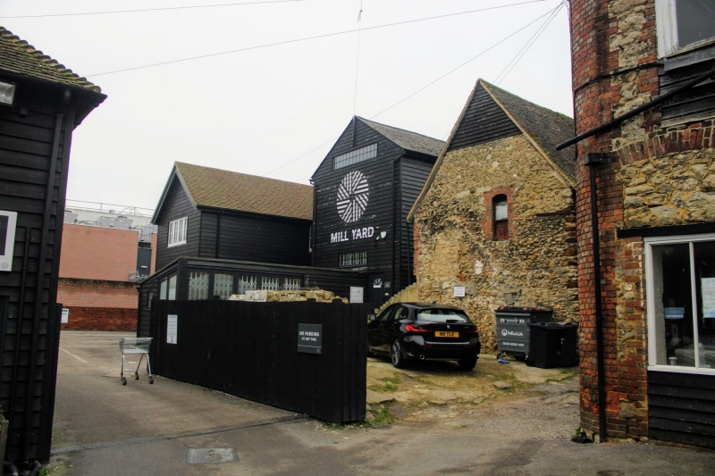
1156-0/3/22 Outbuilding to rear of Nos.81-87
GV II
Outbuilding. c1870. Built of stone rubble with tiled roof and
brick chimneystack. End window has intersecting glazing. One
end is weatherboarded with carved bargeboards and pendant,
Listing NGR: TQ6804757727
External links are from the relevant listing authority and, where applicable, Wikidata. Wikidata IDs may be related buildings as well as this specific building. If you want to add or update a link, you will need to do so by editing the Wikidata entry.


Other nearby listed buildings
