Latitude: 53.4253 / 53°25'30"N
Longitude: -2.9307 / 2°55'50"W
OS Eastings: 338253
OS Northings: 392455
OS Grid: SJ382924
Mapcode National: GBR 7JG.04
Mapcode Global: WH877.Y5MG
Plus Code: 9C5VC3G9+4P
Entry Name: Barclay's Bank
Listing Date: 12 July 1966
Grade: II
Source: Historic England
Source ID: 1218575
English Heritage Legacy ID: 359730
ID on this website: 101218575
Location: Tuebrook, Liverpool, Merseyside, L13
County: Liverpool
Electoral Ward/Division: Tuebrook and Stoneycroft
Parish: Non Civil Parish
Built-Up Area: Liverpool
Traditional County: Lancashire
Lieutenancy Area (Ceremonial County): Merseyside
Church of England Parish: Tuebrook St John
Church of England Diocese: Liverpool
Tagged with: Bank building
SJ 3892 WEST DERBY ROAD (north side) L13
21/1348 No. 611 12.7.66 (Barclay's Bank)
G.V. II
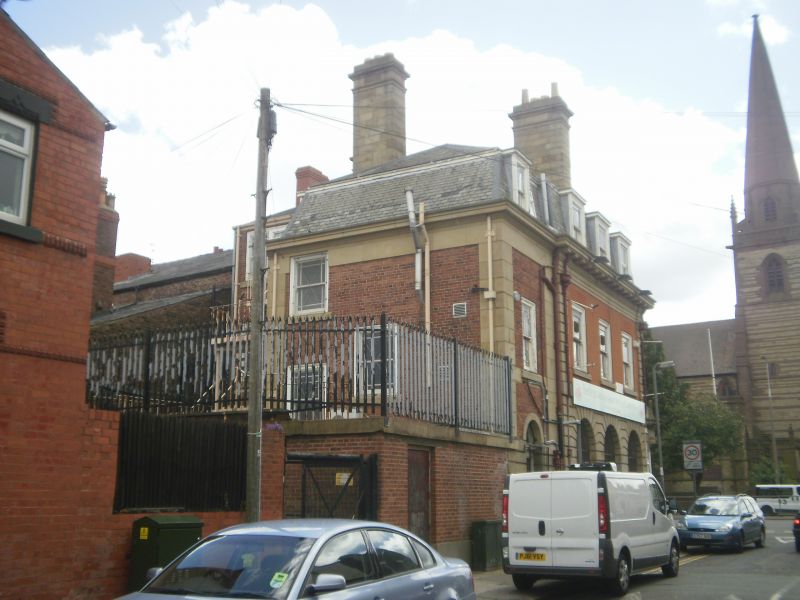
Bank. c.1900. Possibly F. Doyle. Red brick and stone with slate mansard roof. 2 storeys with attic, 3 bays, canted corner bay and 4 bays to Victoria Road (the end bay later). Ground floor has channelled rustication; 1st floor has rusticated quoin strips; top entablature. Ground floor windows are round-headed, with recessed panelled aprons; casements. 1st floor windows have cut-brick flat arches and are sashed with margin lights. Attic has flat-topped dormers with sashes. Corner has entrance with Tuscan columns, curved entablature with antefixae and tented stone roof. 1st floor has channelled rustication. Roof crowned with Liverbird and swags, attic round window, with lead wreath surround, swag and cherub's head. 3 tall stone stacks. Victoria Road facade is similar.
Listing NGR: SJ3825392455
External links are from the relevant listing authority and, where applicable, Wikidata. Wikidata IDs may be related buildings as well as this specific building. If you want to add or update a link, you will need to do so by editing the Wikidata entry.


Other nearby listed buildings