Latitude: 54.1724 / 54°10'20"N
Longitude: -3.1506 / 3°9'2"W
OS Eastings: 324985
OS Northings: 475789
OS Grid: SD249757
Mapcode National: GBR 6NF6.P2
Mapcode Global: WH72B.KDX6
Plus Code: 9C6R5RCX+XP
Entry Name: Drigg and Irton Church Farmhouse and Attached Barn
Listing Date: 25 February 1950
Grade: II
Source: Historic England
Source ID: 1218949
English Heritage Legacy ID: 388616
ID on this website: 101218949
Location: Lindal in Furness, Westmorland and Furness, Cumbria, LA12
County: Westmorland and Furness
District: Barrow-in-Furness
Civil Parish: Lindal and Marton
Built-Up Area: Lindal in Furness
Traditional County: Lancashire
Lieutenancy Area (Ceremonial County): Cumbria
Church of England Parish: Lindal and Marton St Peter
Church of England Diocese: Carlisle
Tagged with: Farmhouse
BARROW IN FURNESS
SD2475 THE GREEN, Lindal In Furness 708-1/9/233 (West side) 25/02/50 Drigg and Irton Church Farmhouse and attached barn
GV II
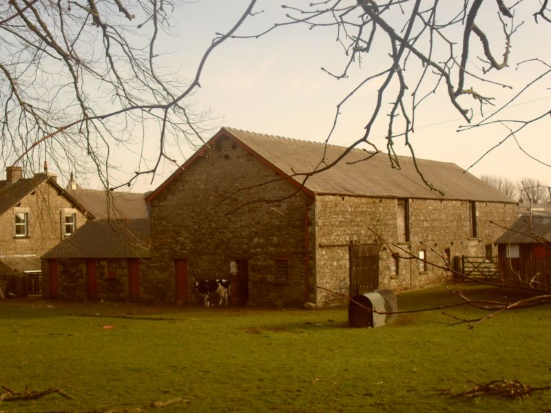
Farmhouse and attached barn. House dated 'WSA 1635', C19 rear wing; barn probably later C17. Roughcast over stone, graduated slate and plain slate roofs. House: 2-storeys, 3 windows to 1st floor; wing to rear right. 4-bay barn to left under same roofline as house. House: triangular-headed doorway on left has studded door, chamfered surround and dripmould; datestone over. Chamfered, mullioned windows to right of 2,4,3 and 3-lights under dripmoulds. 1st floor: three 3-light windows in same style; continuous dripmould. Rendered end stack above door; projecting end stack on right. Barn to left has 2 lean-tos against front wall, each with casement; renewed roof covering. Rear: broad C19 wing; outshut, under catslide roof on right, has stone steps to door in end wall. Barn has waggon entrance; collared, principal-rafter trusses. INTERIOR: farmhouse remodelled C19; beams boxed in; probable inglenook fireplace now concealed.
Listing NGR: SD2498575789
External links are from the relevant listing authority and, where applicable, Wikidata. Wikidata IDs may be related buildings as well as this specific building. If you want to add or update a link, you will need to do so by editing the Wikidata entry.


Other nearby listed buildings