Approximate Location Map
Large Map »
Latitude: 49.9147 / 49°54'53"N
Longitude: -6.3173 / 6°19'2"W
OS Eastings: 90181
OS Northings: 10554
OS Grid: SV901105
Mapcode National: GBR BXSX.95M
Mapcode Global: VGYC4.GD4Q
Plus Code: 8CXMWM7M+V3
Entry Name: 1, Well Lane
Listing Date: 14 December 1992
Grade: II
Source: Historic England
Source ID: 1219099
English Heritage Legacy ID: 62547
ID on this website: 101219099
Location: Hugh Town, Isles of Scilly, Cornwall, TR21
County: Isles of Scilly
Civil Parish: St. Mary's
Built-Up Area: Hugh town
Lieutenancy Area (Ceremonial County): Cornwall
Church of England Parish: Isles of Scilly
Church of England Diocese: Truro
Tagged with: Building
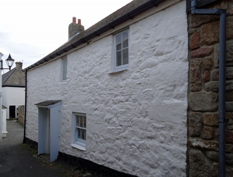
ST. MARY'S
SV9010 WELL LANE, Hugh Town
1358-0/8/106 (East side)
No.1
GV II
House. C18. Whitewashed rubble granite with large quoins and
Delabole
slate roof. 2-unit central-entry plan. 2 storeys; 2-window
range.Panelled door under twin pentice head. Late C19 horned
3/3-pane
sash to ground floor and two 1980s first-floor
casements.Interior:
moulded joists and open fireplaces with granite lintels.
Listing NGR: SV9017810546
External links are from the relevant listing authority and, where applicable, Wikidata. Wikidata IDs may be related buildings as well as this specific building. If you want to add or update a link, you will need to do so by editing the Wikidata entry.


Other nearby listed buildings
