Latitude: 51.3963 / 51°23'46"N
Longitude: -1.3268 / 1°19'36"W
OS Eastings: 446929
OS Northings: 166576
OS Grid: SU469665
Mapcode National: GBR 81Z.FC1
Mapcode Global: VHCZJ.Y5FF
Plus Code: 9C3W9MWF+G7
Entry Name: St Bartholomew's Hospital
Listing Date: 10 June 1969
Grade: II*
Source: Historic England
Source ID: 1219550
English Heritage Legacy ID: 393611
ID on this website: 101219550
Location: City, West Berkshire, RG14
County: West Berkshire
Civil Parish: Newbury
Built-Up Area: Newbury
Traditional County: Berkshire
Lieutenancy Area (Ceremonial County): Berkshire
Church of England Parish: Newbury St John the Evangelist
Church of England Diocese: Oxford
Tagged with: Almshouse
1. ARGYLE ROAD 5127 (east side)
Nos 1 to 27 (odd) St Bartholomew's Hospital SU 4666 NE 7/4 10.6.69
II* GV
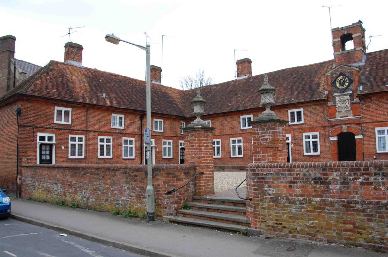
2. Circa 1698 reconstruction of circa 1618 almshouses. The medieval hospital of St Bartholomew was reputedly founded by King John (Berks. Arch. John. 39/1935/38). Restored mid C20. Wing plan with central entrance feature in main range. Two storeys. Hipped tile roof with moulded brick ridgestacks. Central stack over entrance with 4 shafts with arched openings. Brick with moulded eaves cornice. Two-light mullioned windows with leaded lights and transoms to ground floor windows. Semi-elliptical arched entrance with imposts and cherub head on keystone. Clock tower feature over entrance with open pediment with Achievement of Royal Arms quartered (circa 1714-1800) and inscription: "Hospital of St Bartholomew/ Founded by King John 1200-15/This Tower erected 1698." Square-headed doorways to individual almshouses with fanlights ½ and glazed doors. (Trans Newbury Field Club 5.228).
Listing NGR: SU4692966576
External links are from the relevant listing authority and, where applicable, Wikidata. Wikidata IDs may be related buildings as well as this specific building. If you want to add or update a link, you will need to do so by editing the Wikidata entry.


Other nearby listed buildings