Latitude: 51.5374 / 51°32'14"N
Longitude: -0.9089 / 0°54'31"W
OS Eastings: 475773
OS Northings: 182622
OS Grid: SU757826
Mapcode National: GBR C4R.K0Y
Mapcode Global: VHDWG.6MC8
Plus Code: 9C3XG3PR+XF
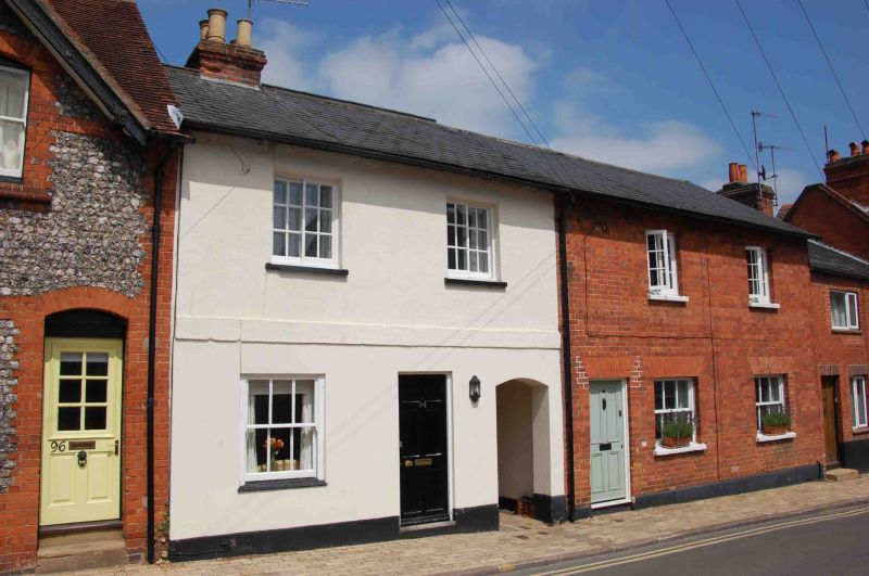
Entry Name: 86 and 94, West Street
Listing Date: 28 October 1974
Grade: II
Source: Historic England
Source ID: 1219659
English Heritage Legacy ID: 246358
ID on this website: 101219659
Location: Henley-on-Thames, South Oxfordshire, RG9
County: Oxfordshire
District: South Oxfordshire
Civil Parish: Henley-on-Thames
Built-Up Area: Henley-on-Thames
Traditional County: Oxfordshire
Lieutenancy Area (Ceremonial County): Oxfordshire
Church of England Parish: Henley-on-Thames
Church of England Diocese: Oxford
Tagged with: Building
1. WEST STREET 5355 (North Side)
Nos 86 & 94 SU 7582 1/424
II GV
2. Early C19. A terrace with roughcast facade and band at 1st floor to No 94. No 86 red brick. Slate roof. 2 storeys 2 windows each. No 86 has modern glazing probably in former window spaces. No 94 has early Cl9 casement and sash, with vertical glazing bars only, to 1st floor. Ground floor has arch to rear. Included in Grade II for group value on street frontage.
No 35, its garden wall, Nos 37 and 39 form a group with Nos 58 to 74 (even) Nos 82 to 114 (even) Nos 124 to 128 (even) and with the pavement surfaces and listed walls above the entrance to Adwell Square (see also Gravel Hill, Hop Gardens and York Road).
Listing NGR: SU7577982624
External links are from the relevant listing authority and, where applicable, Wikidata. Wikidata IDs may be related buildings as well as this specific building. If you want to add or update a link, you will need to do so by editing the Wikidata entry.


Other nearby listed buildings