Latitude: 50.7131 / 50°42'47"N
Longitude: -2.4369 / 2°26'12"W
OS Eastings: 369250
OS Northings: 90475
OS Grid: SY692904
Mapcode National: GBR PY.RN07
Mapcode Global: FRA 57S6.8F9
Plus Code: 9C2VPH77+66
Entry Name: Napper's Mite
Listing Date: 8 May 1950
Last Amended: 8 May 1975
Grade: II*
Source: Historic England
Source ID: 1219851
English Heritage Legacy ID: 393723
ID on this website: 101219851
Location: Dorchester, Dorset, DT1
County: Dorset
Civil Parish: Dorchester
Built-Up Area: Dorchester
Traditional County: Dorset
Lieutenancy Area (Ceremonial County): Dorset
Church of England Parish: Dorchester and West Stafford
Church of England Diocese: Salisbury
Tagged with: Architectural structure
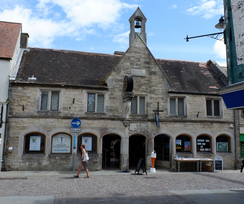
SOUTH STREET
1.
5191
(East Side)
Napper's Mite
(formerly listed as
Napper's Mite
Almhouses).
ST 6990 7/104 8.5.50.
II*
2.
Founded in 1610 by Sir Robert Napper for 10 poor men. there were 10 1-storey
dwellings arranged along the front and round the inner courtyard. The room
over the front range was used for Bible instruction. All buildings have been
much restored, the front apparently re-faced. 2 storey stone front has dwarf
wall and segmental-arched arcade to cloister. Moulded string above ground
floor. 5 2-light casement windows to lst floor. In centre is parapetted gable
with gabled bell-cote. Not quite in centre of gable is a corbel bracket supporting
a clock (C19). Central doorway leads to small square courtyard surrounded
by l-storey dwellings.
Courtyard has mullioned casements with hollow chamfered mouldings. 2 pairs
of brick stacks diagonally placed. 3 tall brick C18 stacks.
Rear has 1 gable at each end. Central gabled porch. 5 mullioned casements
with hoodmoulds that on left side (the chapel) with 3 arched lights.
Listing NGR: SY6925090475
External links are from the relevant listing authority and, where applicable, Wikidata. Wikidata IDs may be related buildings as well as this specific building. If you want to add or update a link, you will need to do so by editing the Wikidata entry.


Other nearby listed buildings