Latitude: 54.1358 / 54°8'9"N
Longitude: -0.7931 / 0°47'35"W
OS Eastings: 478950
OS Northings: 471784
OS Grid: SE789717
Mapcode National: GBR QNXM.25
Mapcode Global: WHFBG.S9JQ
Plus Code: 9C6X46P4+8Q
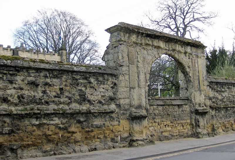
Entry Name: Screen Wall Approximately 35 Metres North West of Malton Lodge
Listing Date: 29 September 1951
Last Amended: 5 April 1993
Grade: II*
Source: Historic England
Source ID: 1219922
English Heritage Legacy ID: 389495
ID on this website: 101219922
Location: Malton, North Yorkshire, YO17
County: North Yorkshire
District: Ryedale
Civil Parish: Malton
Built-Up Area: Malton
Traditional County: Yorkshire
Lieutenancy Area (Ceremonial County): North Yorkshire
Church of England Parish: New Malton St Michael
Church of England Diocese: York
Tagged with: Wall
MALTON
SE780715 OLD MALTONGATE 801-1/8/114 (South side) 29/09/51 Screen wall approx. 35m NW of Malton Lodge (Formerly Listed as: OLD MALTONGATE (South side) Malton Lodge and screen wall to N)
GV II*
Courtyard wall. c1604, altered c1675. For Ralph, Lord Eure. Dressed sandstone, now badly decayed with defaced mouldings. Wall approx 70m long, containing arched central gate, later blocked and replaced by present gates at each end. Approx 5m high, rising over arches to approx 6.5m. Round centre arch of voussoirs between paired pilasters on bulbous moulded pedestals, with imposts or caps, possible triglyph frieze and moulded projecting cornice. To left, elliptical arch between pilaster buttresses, probably matched originally by arch at right end. Wall flanking arches incorporates weathered course at approximately mid height and has sloped coping. Wall formed part of the screen wall to the outer forecourt of the former Eure mansion, the remains of which are now known as Malton Lodge (qv).
Listing NGR: SE7895071784
External links are from the relevant listing authority and, where applicable, Wikidata. Wikidata IDs may be related buildings as well as this specific building. If you want to add or update a link, you will need to do so by editing the Wikidata entry.


Other nearby listed buildings