Approximate Location Map
Large Map »
Latitude: 51.4838 / 51°29'1"N
Longitude: -2.7802 / 2°46'48"W
OS Eastings: 345917
OS Northings: 176378
OS Grid: ST459763
Mapcode National: GBR JG.KRCY
Mapcode Global: VH7BW.RYKX
Plus Code: 9C3VF6M9+GW
Entry Name: Severn House
Listing Date: 4 August 1981
Grade: II
Source: Historic England
Source ID: 1220362
English Heritage Legacy ID: 394095
ID on this website: 101220362
Location: West Hill, North Somerset, BS20
County: North Somerset
Civil Parish: Portishead
Built-Up Area: Portishead
Traditional County: Somerset
Lieutenancy Area (Ceremonial County): Somerset
Tagged with: House
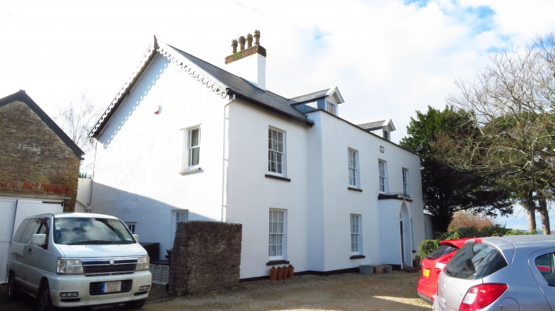
1.
5121 WEST BILL
(west side)
No 34
(Severn House)
ST 47 NE 1/25
II
2.
Dated 1804. Rendered, slate roof. Two storeys and attic; 3 windows plus
one in setback wing to left, glazing bar sashes; 2 gabled dormers. Porch
with pointed arch door head. Datestones above central window:
JB and JB
1804 1979 (for restoration).
Listing NGR: ST4591776378
External links are from the relevant listing authority and, where applicable, Wikidata. Wikidata IDs may be related buildings as well as this specific building. If you want to add or update a link, you will need to do so by editing the Wikidata entry.


Other nearby listed buildings
