Approximate Location Map
Large Map »
Latitude: 51.4117 / 51°24'42"N
Longitude: -1.3188 / 1°19'7"W
OS Eastings: 447472
OS Northings: 168294
OS Grid: SU474682
Mapcode National: GBR 81S.HDB
Mapcode Global: VHCZC.3S55
Plus Code: 9C3WCM6J+MF
Entry Name: Tomb Approximately 14 Metres to South of Nave of Church of St Mary
Listing Date: 16 August 1983
Grade: II
Source: Historic England
Source ID: 1220377
English Heritage Legacy ID: 394117
ID on this website: 101220377
Location: St Mary's Church, Shaw, West Berkshire, RG14
County: West Berkshire
Civil Parish: Shaw cum Donnington
Built-Up Area: Newbury
Traditional County: Berkshire
Lieutenancy Area (Ceremonial County): Berkshire
Church of England Parish: Shaw cum Donnington
Church of England Diocese: Oxford
Tagged with: Tomb
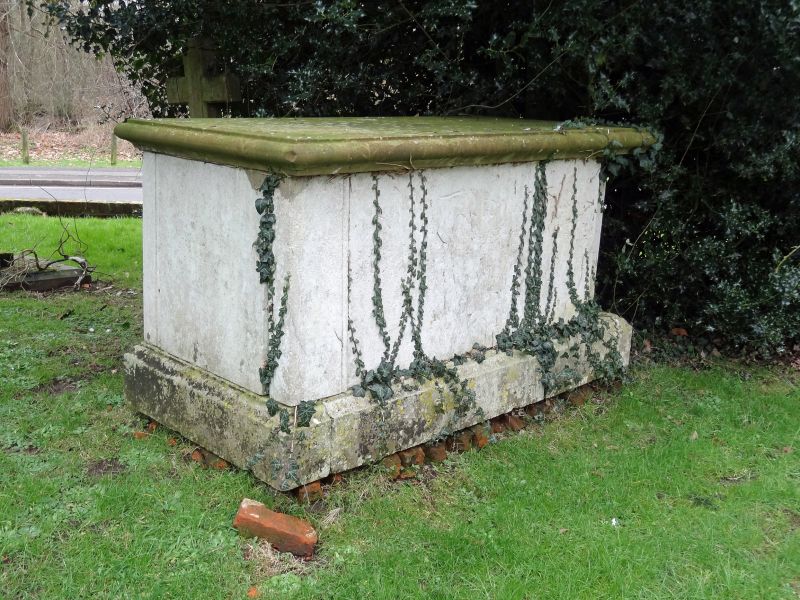
SU 46NE SHAW CUM DONNINGTON CHURCH ROAD
(north side)
7/27 Tomb Approximately
14 Metres To South
Of Nave Of Church
Of St.Mary
GV II
Chest tomb. 1802. Ashlar. Moulded top and base.
Listing NGR: SU4747268294
External links are from the relevant listing authority and, where applicable, Wikidata. Wikidata IDs may be related buildings as well as this specific building. If you want to add or update a link, you will need to do so by editing the Wikidata entry.


Other nearby listed buildings
