Latitude: 50.714 / 50°42'50"N
Longitude: -2.4407 / 2°26'26"W
OS Eastings: 368984
OS Northings: 90574
OS Grid: SY689905
Mapcode National: GBR PY.RDZM
Mapcode Global: FRA 57S6.0ZG
Plus Code: 9C2VPH75+HP
Entry Name: 4 and 5, West Walks
Listing Date: 8 May 1950
Grade: II
Source: Historic England
Source ID: 1220852
English Heritage Legacy ID: 394532
ID on this website: 101220852
Location: Dorchester, Dorset, DT1
County: Dorset
Civil Parish: Dorchester
Built-Up Area: Dorchester
Traditional County: Dorset
Lieutenancy Area (Ceremonial County): Dorset
Church of England Parish: Dorchester and West Stafford
Church of England Diocese: Salisbury
Tagged with: Building
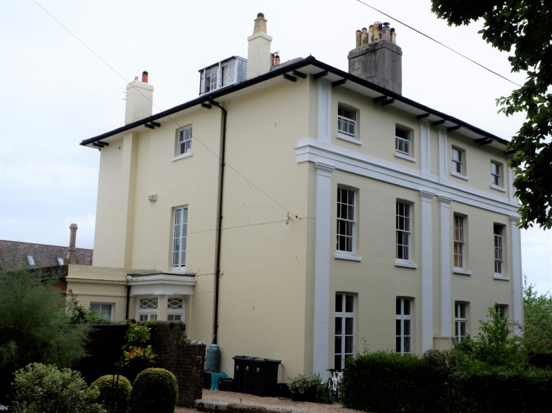
WEST WALKS
1.
519l
(East Side)
Nos 4 & 5
SY 6890 7/304 8.5.50.
II GV
2.
Mid C19. Stucco. Hipped slate roof with overhanging bracketed eaves. 3 storeys.
4 ranges of sashes with glazing bars, French windows on ground floor. Giant
Tuscan pilaster order to ground and 1st floors. Panelled pilasters to 2nd Floor.
Nos 1 to 6 (consec),including wall between Nos 5 and 6 form a group.
Listing NGR: SY6898490574
External links are from the relevant listing authority and, where applicable, Wikidata. Wikidata IDs may be related buildings as well as this specific building. If you want to add or update a link, you will need to do so by editing the Wikidata entry.


Other nearby listed buildings