Latitude: 50.6697 / 50°40'10"N
Longitude: -1.2092 / 1°12'33"W
OS Eastings: 455978
OS Northings: 85854
OS Grid: SZ559858
Mapcode National: GBR 9D5.T9W
Mapcode Global: FRA 87C9.LQ5
Plus Code: 9C2WMQ9R+V8
Entry Name: Spicers Bridge
Listing Date: 14 February 1992
Grade: II
Source: Historic England
Source ID: 1221208
English Heritage Legacy ID: 310199
ID on this website: 101221208
Location: Langbridge, Isle of Wight, PO36
County: Isle of Wight
Civil Parish: Newchurch
Built-Up Area: Newchurch
Traditional County: Hampshire
Lieutenancy Area (Ceremonial County): Isle of Wight
Church of England Parish: Newchurch All Saints
Church of England Diocese: Portsmouth
Tagged with: Bridge
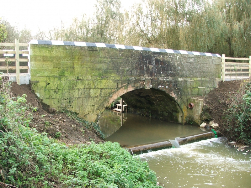
NEWCHURCH
SZ58NE THE SHUTE
1352-0/1/160 Spicers Bridge
II
Bridge. Early C19. Built of tooled ashlar. Downstream side has
one round-headed arch with keystone and stringcourse. Parapet
about 3ft high with triangular stone coping. Upstream side has
longer parapet. Arch on this side not seen because of dense
undergrowth.
Listing NGR: SZ5597885854
External links are from the relevant listing authority and, where applicable, Wikidata. Wikidata IDs may be related buildings as well as this specific building. If you want to add or update a link, you will need to do so by editing the Wikidata entry.


Other nearby listed buildings