Approximate Location Map
Large Map »
Latitude: 50.9849 / 50°59'5"N
Longitude: 0.4746 / 0°28'28"E
OS Eastings: 573784
OS Northings: 123521
OS Grid: TQ737235
Mapcode National: GBR PVN.0T4
Mapcode Global: FRA C6WH.W4J
Plus Code: 9F22XFMF+WR
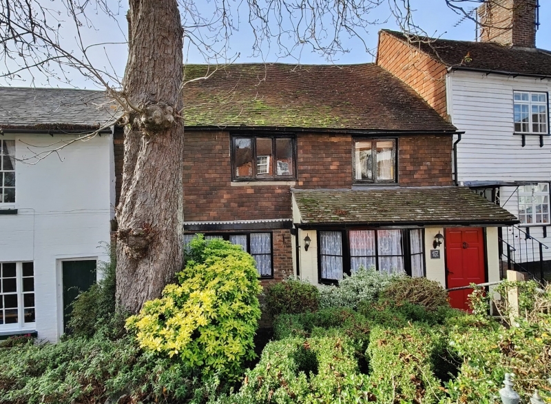
Entry Name: Number 67 and Swifts
Listing Date: 13 May 1987
Grade: II
Source: Historic England
Source ID: 1221421
English Heritage Legacy ID: 413180
ID on this website: 101221421
Location: Robertsbridge, Rother, East Sussex, TN32
County: East Sussex
District: Rother
Civil Parish: Salehurst and Robertsbridge
Built-Up Area: Robertsbridge
Traditional County: Sussex
Lieutenancy Area (Ceremonial County): East Sussex
Church of England Parish: Salehurst St Mary
Church of England Diocese: Chichester
Tagged with: Building
TQ 7223-7323
42/28
SALEHURST
HIGH STREET, Robertsbridge
(west side)
No 67 and Swifts
GV
II
One building. Early C17. 2 storeys. 2 windows. Ground floor red brick, above
tile-hung. Tiled roof. Casement windows. Ground floor built out as a shop, though
not now used as such.
Listing NGR: TQ7378423521
External links are from the relevant listing authority and, where applicable, Wikidata. Wikidata IDs may be related buildings as well as this specific building. If you want to add or update a link, you will need to do so by editing the Wikidata entry.


Other nearby listed buildings
