Approximate Location Map
Large Map »
Latitude: 50.7298 / 50°43'47"N
Longitude: -1.16 / 1°9'35"W
OS Eastings: 459383
OS Northings: 92578
OS Grid: SZ593925
Mapcode National: GBR 9CN.1KC
Mapcode Global: FRA 87G4.V8G
Plus Code: 9C2WPRHR+W2
Entry Name: Railings of No 9
Listing Date: 18 May 1972
Grade: II
Source: Historic England
Source ID: 1221508
English Heritage Legacy ID: 413337
ID on this website: 101221508
Location: Ryde, Isle of Wight, PO33
County: Isle of Wight
Civil Parish: Ryde
Built-Up Area: Ryde
Traditional County: Hampshire
Lieutenancy Area (Ceremonial County): Isle of Wight
Church of England Parish: Oakfield St John
Church of England Diocese: Portsmouth
Tagged with: Guard rail
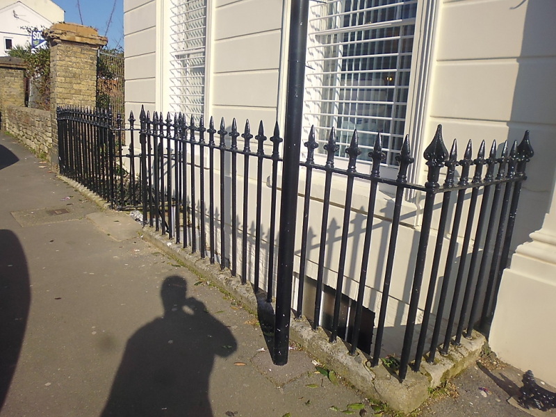
MELVILLE STREET
1.
1577
(North Side)
Railings of No 9
SZ 5992 2/253A
II
2.
Cast iron spear head railings in line with pavement in front of No 9.
Listing NGR: SZ5938392578
External links are from the relevant listing authority and, where applicable, Wikidata. Wikidata IDs may be related buildings as well as this specific building. If you want to add or update a link, you will need to do so by editing the Wikidata entry.


Other nearby listed buildings
