Approximate Location Map
Large Map »
Latitude: 50.9912 / 50°59'28"N
Longitude: -0.7578 / 0°45'28"W
OS Eastings: 487278
OS Northings: 122041
OS Grid: SU872220
Mapcode National: GBR DDW.TDY
Mapcode Global: FRA 969H.GKM
Plus Code: 9C2XX6RR+FV
Entry Name: Woolbeding Bridge
Listing Date: 18 June 1959
Grade: II*
Source: Historic England
Source ID: 1221570
English Heritage Legacy ID: 413412
ID on this website: 101221570
Location: Woolbeding, Chichester, West Sussex, GU29
County: West Sussex
District: Chichester
Civil Parish: Woolbeding with Redford
Traditional County: Sussex
Lieutenancy Area (Ceremonial County): West Sussex
Church of England Parish: Woolbeding All Hallows
Church of England Diocese: Chichester
Tagged with: Bridge Road bridge
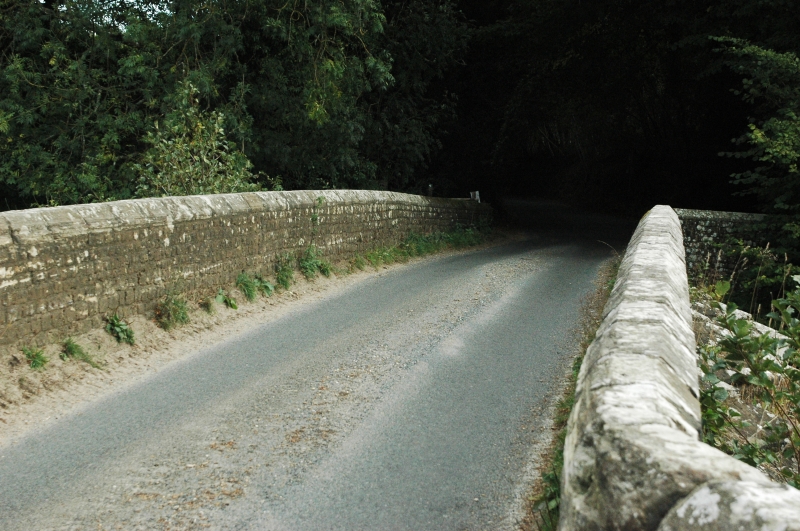
SU 82 SE WOOLBEDING WOOLBEDING LANE
11/31 Woolbeding Bridge
18.6.59
- II*
C15-16. Stone. 4 segmental arches with 3 chamfered ribs. 3 pointed cutwaters on
each side. Parapet renewed. Restored in 1919. Scheduled Ancient Monument.
Listing NGR: SU8727822041
External links are from the relevant listing authority and, where applicable, Wikidata. Wikidata IDs may be related buildings as well as this specific building. If you want to add or update a link, you will need to do so by editing the Wikidata entry.


Other nearby listed buildings
