Latitude: 52.105 / 52°6'17"N
Longitude: -0.3238 / 0°19'25"W
OS Eastings: 514895
OS Northings: 246508
OS Grid: TL148465
Mapcode National: GBR H3W.WG4
Mapcode Global: VHGMZ.BCN5
Plus Code: 9C4X4M3G+XF
Entry Name: The Crown Public House
Listing Date: 31 October 1966
Grade: II
Source: Historic England
Source ID: 1221858
English Heritage Legacy ID: 413775
ID on this website: 101221858
Location: Northill, Central Bedfordshire, SG18
County: Central Bedfordshire
Civil Parish: Northill
Built-Up Area: Northill
Traditional County: Bedfordshire
Lieutenancy Area (Ceremonial County): Bedfordshire
Church of England Parish: Northill
Church of England Diocese: St.Albans
Tagged with: Pub
TL 1446 NORTHILL ICKWELL ROAD (West Side)
8/84 The Crown Public House 31.10.66 GV II
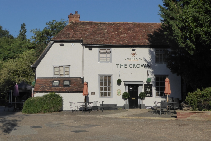
Public house. C17, C18 and C19. Partly timber framed construction with colourwashed roughcast exterior, partly of brick with colourwashed roughcast render. Clay tile roofs. L-plan, of 2 storeys. SW block is C17 with C18 additions, and slightly lower than front block. Ground floor has one 3-light casement, 2 C19 canted bays flanking plank door, one 2-light casement and one single light. First floor has 2 2-light casements. All windows have glazing bars, some are C20. 2 rebuilt red brick multiple ridge stacks, LH one serving back-to-back hearth. Front block is C19. 2 ground floor sash windows flank doorway with moulded surround, flat hood and C20 glazed door. First floor has 2 C20 replacement windows. LH gable has 4 C20 casements to ground floor and one 3-light casement to first floor. All windows have glazing bars. External red brick stack to N gable end.
Listing NGR: TL1489546508
External links are from the relevant listing authority and, where applicable, Wikidata. Wikidata IDs may be related buildings as well as this specific building. If you want to add or update a link, you will need to do so by editing the Wikidata entry.


Other nearby listed buildings