Approximate Location Map
Large Map »
Latitude: 51.0186 / 51°1'6"N
Longitude: 0.3895 / 0°23'22"E
OS Eastings: 567694
OS Northings: 127075
OS Grid: TQ676270
Mapcode National: GBR NST.394
Mapcode Global: FRA C6PF.CJR
Plus Code: 9F32299Q+CR
Entry Name: Old Battenhurst Farmhouse
Listing Date: 13 May 1987
Grade: II
Source: Historic England
Source ID: 1222089
English Heritage Legacy ID: 414181
ID on this website: 101222089
Location: Rother, East Sussex, TN5
County: East Sussex
District: Rother
Civil Parish: Ticehurst
Traditional County: Sussex
Lieutenancy Area (Ceremonial County): East Sussex
Church of England Parish: Stonegate St Peter
Church of England Diocese: Chichester
Tagged with: Farmhouse
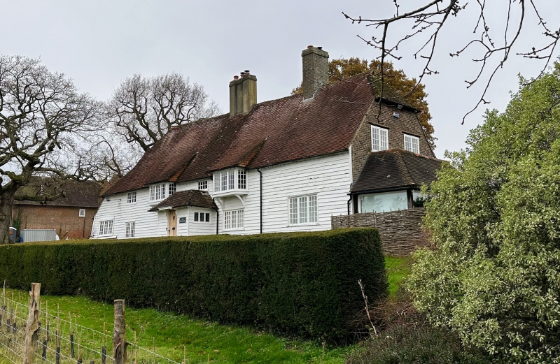
TQ 62 NE TICEHURST BATTENHURST ROAD
4/23 Old Battenhurst Farmhouse
II
Probably C17. Two storeys. Five windows. Faced with weatherboarding. Half-
hipped tiled roof. Casement windows. Modern porch.
Listing NGR: TQ6769427075
External links are from the relevant listing authority and, where applicable, Wikidata. Wikidata IDs may be related buildings as well as this specific building. If you want to add or update a link, you will need to do so by editing the Wikidata entry.


Other nearby listed buildings
