Latitude: 51.0303 / 51°1'49"N
Longitude: 0.3884 / 0°23'18"E
OS Eastings: 567572
OS Northings: 128376
OS Grid: TQ675283
Mapcode National: GBR NSM.90S
Mapcode Global: FRA C6PD.C41
Plus Code: 9F3229JQ+48
Entry Name: Cottenden Farmhouse
Listing Date: 13 May 1987
Grade: II
Source: Historic England
Source ID: 1222286
English Heritage Legacy ID: 414423
ID on this website: 101222286
Location: Cottenden, Rother, East Sussex, TN5
County: East Sussex
District: Rother
Civil Parish: Ticehurst
Traditional County: Sussex
Lieutenancy Area (Ceremonial County): East Sussex
Church of England Parish: Stonegate St Peter
Church of England Diocese: Chichester
Tagged with: Farmhouse
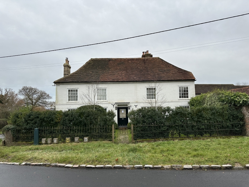
TQ 62 NE TICEHURST COTTENDEN ROAD
Stonegate
4/10
Cottenden Farmhouse
II
C18. Two storeys. Four windows. Painted brick. Stringcourse. Eaves cornice.
Hipped tiled roof. Glazing bars intact. Doorway with flat hood over. Later
wing behind to south east.
Listing NGR: TQ6757228376
External links are from the relevant listing authority and, where applicable, Wikidata. Wikidata IDs may be related buildings as well as this specific building. If you want to add or update a link, you will need to do so by editing the Wikidata entry.


Other nearby listed buildings