Latitude: 50.7578 / 50°45'28"N
Longitude: -1.5699 / 1°34'11"W
OS Eastings: 430436
OS Northings: 95442
OS Grid: SZ304954
Mapcode National: GBR 66Q.KWJ
Mapcode Global: FRA 77L2.Q79
Plus Code: 9C2WQC5J+43
Entry Name: Culverlea House
Listing Date: 28 October 1974
Grade: II
Source: Historic England
Source ID: 1222246
English Heritage Legacy ID: 414298
ID on this website: 101222246
Location: Upper Pennington, New Forest, Hampshire, SO41
County: Hampshire
District: New Forest
Civil Parish: Lymington and Pennington
Built-Up Area: Lymington
Traditional County: Hampshire
Lieutenancy Area (Ceremonial County): Hampshire
Church of England Parish: Pennington St Mark
Church of England Diocese: Winchester
Tagged with: House
1.
5235 RAMLEY ROAD
(South West Side)
PENNINGTON
-----------------
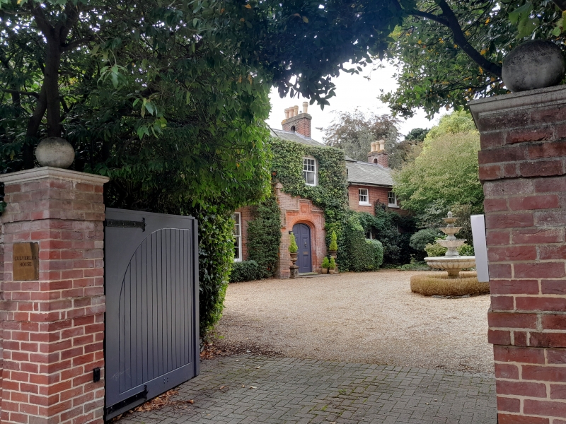
Culverlea House
SZ 3295 7/293
II
2.
Earlier C19. Red brick, slate roof. In 3 parts, centre advanced under gable and
east and west wings flanking this 2 storeys. 6 windows, sashes with glazing bars.
Later panelled double door.
Listing NGR: SZ3043695442
External links are from the relevant listing authority and, where applicable, Wikidata. Wikidata IDs may be related buildings as well as this specific building. If you want to add or update a link, you will need to do so by editing the Wikidata entry.


Other nearby listed buildings