Approximate Location Map
Large Map »
Latitude: 50.7613 / 50°45'40"N
Longitude: -1.5659 / 1°33'57"W
OS Eastings: 430712
OS Northings: 95830
OS Grid: SZ307958
Mapcode National: GBR 66R.0YL
Mapcode Global: FRA 77L2.KRB
Plus Code: 9C2WQC6M+GJ
Entry Name: Yaldhurst Farm House
Listing Date: 28 October 1974
Grade: II
Source: Historic England
Source ID: 1238081
English Heritage Legacy ID: 415435
ID on this website: 101238081
Location: Upper Pennington, New Forest, Hampshire, SO41
County: Hampshire
District: New Forest
Civil Parish: Lymington and Pennington
Built-Up Area: Lymington
Traditional County: Hampshire
Lieutenancy Area (Ceremonial County): Hampshire
Church of England Parish: Pennington St Mark
Church of England Diocese: Winchester
Tagged with: Farmhouse
1.
5235 YALDHURST LANE
(North End)
PENNINGTON
--------------
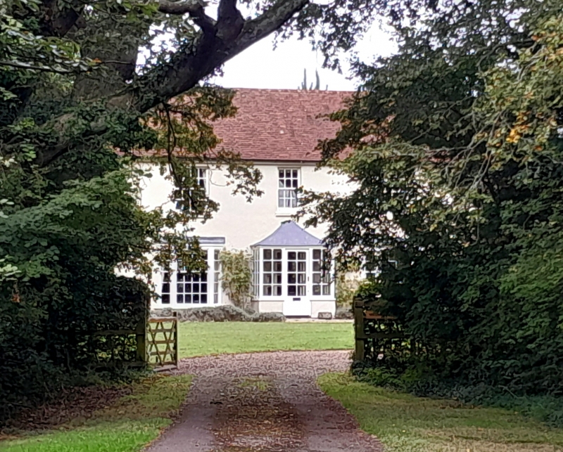
SZ 3095 7/346 Yaldhurst Farm House
II
2.
Late C18/early C19. stucco facade with tiled roof. 2 storeys, 3 windows, sashes
with glazing bars. Centre porch has reproduction bow windows each side.
Listing NGR: SZ3071195830
External links are from the relevant listing authority and, where applicable, Wikidata. Wikidata IDs may be related buildings as well as this specific building. If you want to add or update a link, you will need to do so by editing the Wikidata entry.


Other nearby listed buildings
