Approximate Location Map
Large Map »
Latitude: 51.0472 / 51°2'49"N
Longitude: 0.4071 / 0°24'25"E
OS Eastings: 568823
OS Northings: 130291
OS Grid: TQ688302
Mapcode National: GBR NSG.7RH
Mapcode Global: FRA C6RC.0F6
Plus Code: 9F322CW4+VR
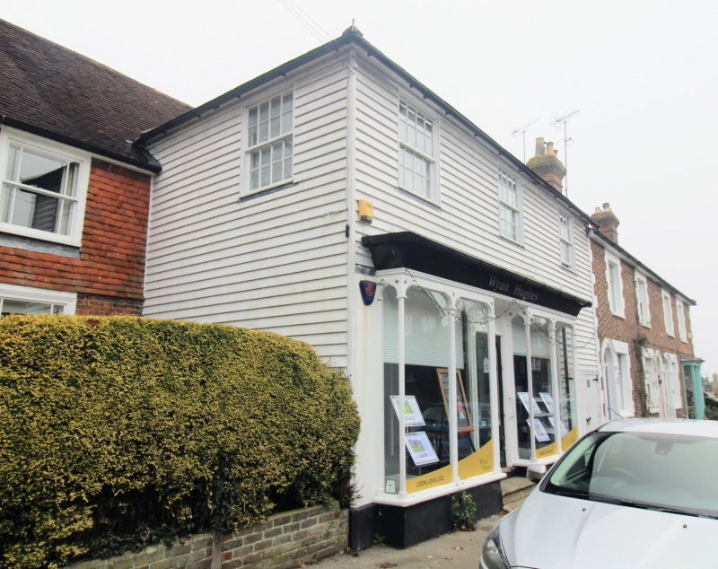
Entry Name: 36, High Street
Listing Date: 13 May 1987
Grade: II
Source: Historic England
Source ID: 1222575
English Heritage Legacy ID: 414592
ID on this website: 101222575
Location: Ticehurst, Rother, East Sussex, TN5
County: East Sussex
District: Rother
Civil Parish: Ticehurst
Built-Up Area: Ticehurst
Traditional County: Sussex
Lieutenancy Area (Ceremonial County): East Sussex
Church of England Parish: Ticehurst St Mary
Church of England Diocese: Chichester
Tagged with: Building
TQ 6830-6930
34/37
TICEHURST
HIGH STREET (north side)
No 36
GV
II
Early C19. Two storeys. One window. Faced with weather-boarding. Hipped slate roof. C19 shop window. Glazing bars intact above. Formerly the premises of H E Waterhouse, Grocer.
Listing NGR: TQ6882330291
External links are from the relevant listing authority and, where applicable, Wikidata. Wikidata IDs may be related buildings as well as this specific building. If you want to add or update a link, you will need to do so by editing the Wikidata entry.


Other nearby listed buildings
