Latitude: 51.3696 / 51°22'10"N
Longitude: 1.4418 / 1°26'30"E
OS Eastings: 639655
OS Northings: 169011
OS Grid: TR396690
Mapcode National: GBR X07.5B9
Mapcode Global: VHMCP.YT2Z
Plus Code: 9F339C9R+RP
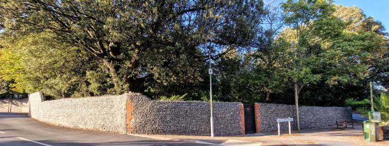
Entry Name: Wall Surrounding Stone House
Listing Date: 20 September 1974
Grade: II
Source: Historic England
Source ID: 1222610
English Heritage Legacy ID: 417970
ID on this website: 101222610
Location: Reading Street, Thanet, Kent, CT10
County: Kent
District: Thanet
Civil Parish: Broadstairs and St. Peters
Built-Up Area: Broadstairs
Traditional County: Kent
Lieutenancy Area (Ceremonial County): Kent
Tagged with: Wall
1. NORTH FORELAND ROAD 5283 (West Side) BROADSTAIRS Wall surrounding Stone House TR 36 NE 5/30A II
Probably C19. A flint wall about 8 ft in height. 2 stuccoed and panelled gatepiers.
Listing NGR: TR3968269013
External links are from the relevant listing authority and, where applicable, Wikidata. Wikidata IDs may be related buildings as well as this specific building. If you want to add or update a link, you will need to do so by editing the Wikidata entry.


Other nearby listed buildings