Approximate Location Map
Large Map »
Latitude: 51.7444 / 51°44'39"N
Longitude: -2.2135 / 2°12'48"W
OS Eastings: 385356
OS Northings: 205096
OS Grid: SO853050
Mapcode National: GBR 1MK.R5J
Mapcode Global: VH94Y.LF53
Plus Code: 9C3VPQVP+PJ
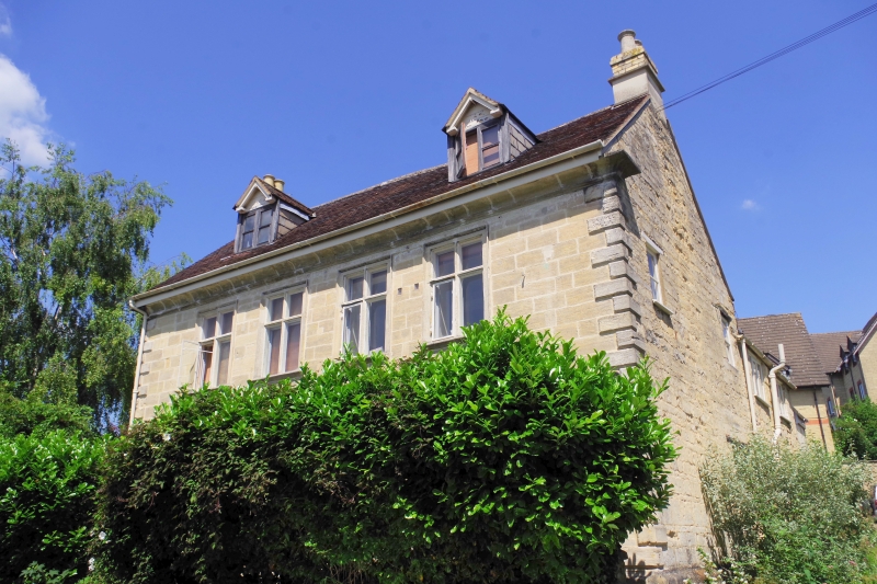
Entry Name: Laurel Villa
Listing Date: 1 May 1951
Grade: II
Source: Historic England
Source ID: 1222644
English Heritage Legacy ID: 418034
ID on this website: 101222644
Location: Stroud, Gloucestershire, GL5
County: Gloucestershire
District: Stroud
Civil Parish: Stroud
Built-Up Area: Stroud
Traditional County: Gloucestershire
Lieutenancy Area (Ceremonial County): Gloucestershire
Church of England Parish: Stroud St Laurence
Church of England Diocese: Gloucester
Tagged with: Villa
1. NELSON STREET
5227
(North Side)
No 7 (Laurel Villa)
SO 8505 5/48 1.5.51.
II
2.
Early C18. Stone. 2 storeys. 4 windows (casements with stone mullions and
transoms and architraves). Coved eaves cornice. Long and short chamfered quoins
Tile roof.
Listing NGR: SO8535605096
External links are from the relevant listing authority and, where applicable, Wikidata. Wikidata IDs may be related buildings as well as this specific building. If you want to add or update a link, you will need to do so by editing the Wikidata entry.


Other nearby listed buildings
