Approximate Location Map
Large Map »
Latitude: 51.7499 / 51°44'59"N
Longitude: -2.2225 / 2°13'20"W
OS Eastings: 384736
OS Northings: 205710
OS Grid: SO847057
Mapcode National: GBR 1MK.8XT
Mapcode Global: VH94Y.F8DW
Plus Code: 9C3VPQXH+X2
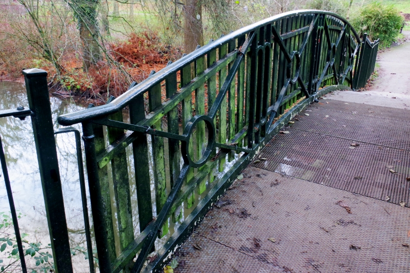
Entry Name: Iron Bridge in Stratford Park to the East of the House
Listing Date: 14 August 1967
Grade: II
Source: Historic England
Source ID: 1223135
English Heritage Legacy ID: 418691
ID on this website: 101223135
Location: Stratford Park, Beeches Green, Stroud, Gloucestershire, GL5
County: Gloucestershire
District: Stroud
Civil Parish: Stroud
Built-Up Area: Stroud
Traditional County: Gloucestershire
Lieutenancy Area (Ceremonial County): Gloucestershire
Church of England Parish: Uplands All Saints
Church of England Diocese: Gloucester
Tagged with: Bridge
1. STRATFORD ROAD
5227
(North Side)
Iron bridge in
Stratford Park to the
east of the house
SO 8405 5/67A 14.8.67.
II
2.
Early C19: Cast iron, with ornamental circles in spandrels and balustrade.
Listing NGR: SO8473605710
External links are from the relevant listing authority and, where applicable, Wikidata. Wikidata IDs may be related buildings as well as this specific building. If you want to add or update a link, you will need to do so by editing the Wikidata entry.


Other nearby listed buildings
