Approximate Location Map
Large Map »
Latitude: 50.7257 / 50°43'32"N
Longitude: -3.5385 / 3°32'18"W
OS Eastings: 291505
OS Northings: 92914
OS Grid: SX915929
Mapcode National: GBR P0.PXHK
Mapcode Global: FRA 37G5.C7W
Plus Code: 9C2RPFG6+7J
Entry Name: 31, St Davids Hill
Listing Date: 29 January 1953
Grade: II
Source: Historic England
Source ID: 1223390
English Heritage Legacy ID: 418993
ID on this website: 101223390
Location: Exeter, Devon, EX4
County: Devon
District: Exeter
Electoral Ward/Division: St David's
Parish: Non Civil Parish
Built-Up Area: Exeter
Traditional County: Devon
Lieutenancy Area (Ceremonial County): Devon
Church of England Parish: Exeter St David
Church of England Diocese: Exeter
Tagged with: Building
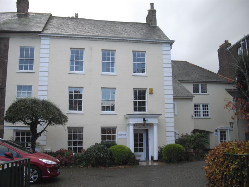
ST DAVID'S HILL
1.
l092
(West Side)
No 31
SX 9192 NE 2/121
SX 99 SW 24/121 29.1.53
II GV
2.
Late C18. Stucco with rusticated quoins. Three storeys, five windows, sashes,
with the glazing bars removed on ground and first floors. Tuscan porch, panelled
door with glazed panels. Modillion cornice, slate roof.
Nos 27 to 37 (odd) form a group.
Listing NGR: SX9150592914
External links are from the relevant listing authority and, where applicable, Wikidata. Wikidata IDs may be related buildings as well as this specific building. If you want to add or update a link, you will need to do so by editing the Wikidata entry.


Other nearby listed buildings
