Latitude: 51.3308 / 51°19'50"N
Longitude: 1.3176 / 1°19'3"E
OS Eastings: 631211
OS Northings: 164302
OS Grid: TR312643
Mapcode National: GBR X0G.HY5
Mapcode Global: VHLGC.STF6
Plus Code: 9F3388J9+82
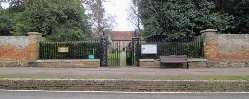
Entry Name: Gates and Walls to Minster Abbey
Listing Date: 7 October 1986
Grade: II
Source: Historic England
Source ID: 1223810
English Heritage Legacy ID: 419677
ID on this website: 101223810
MINSTER CHURCH STREET TR 3064-3164 North Side) 5/11 Gates and walls to Minster Abbey GV II Wall and gates. C17 and early C19. Brown brick, the base in English bond, and flint. Cast iron gates. Wall about 6 1/2 feet high, extending about 65 yards (and then returned north) to left, and 35 yards (and returned north) to right of gate. Paired gates with spiked uprights and swept top rail, with pierced iron piers with large spear head finials. Railings 5 yards to left and right of gate on low brick base.
Listing NGR: TR3121164302
External links are from the relevant listing authority and, where applicable, Wikidata. Wikidata IDs may be related buildings as well as this specific building. If you want to add or update a link, you will need to do so by editing the Wikidata entry.


Other nearby listed buildings