Latitude: 51.3307 / 51°19'50"N
Longitude: 1.3184 / 1°19'6"E
OS Eastings: 631264
OS Northings: 164292
OS Grid: TR312642
Mapcode National: GBR X0G.J40
Mapcode Global: VHLGC.STT8
Plus Code: 9F3388J9+78
Entry Name: Garden Cottage and Garden Wall
Listing Date: 7 October 1986
Grade: II
Source: Historic England
Source ID: 1223817
English Heritage Legacy ID: 419689
ID on this website: 101223817
Location: Durlock, Thanet, Kent, CT12
County: Kent
District: Thanet
Civil Parish: Minster
Built-Up Area: Minster (Thanet)
Traditional County: Kent
Lieutenancy Area (Ceremonial County): Kent
Tagged with: Cottage Thatched cottage
This list entry was subject to a Minor Amendment on 2 October 2025 to update the Address and reformat the text to current standards
TR 3064-3164
5/23
MINSTER
DURLOCK
Garden Cottage and Garden Wall
(Formerly listed as CHURCH STREET (South Side), previously listed as Durlock Garden Cottage)
GV
II
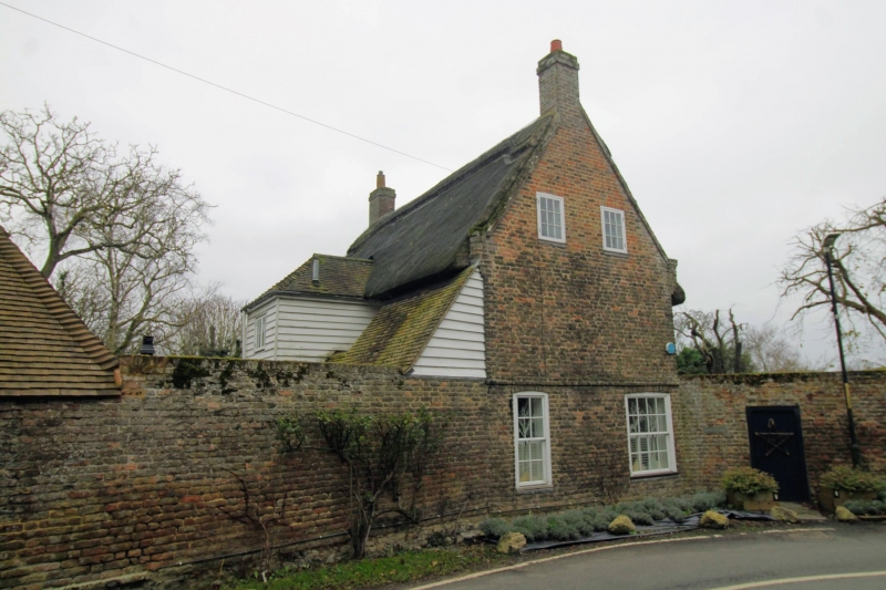
House. c1700. Brown brick and thatched roof. Two storeys and attic. The brickwork bonded with courses of stretchers alternating with courses of headers and stretchers, the mortar courses galleted. Plinth, plat band and kneelered paprapet gables. Dormer window and stacks to left and end right. Regular fenestration of two wooden casements on first floor and two glazing bar sashes on ground floor with central half-glazed door and flat hood on brackets.
Interior altered.
Garden wall attached to left return of house, in brown brick, about 8 feet high and extending about 10 yards west of house to change in direction.
Listing NGR: TR3126464292
External links are from the relevant listing authority and, where applicable, Wikidata. Wikidata IDs may be related buildings as well as this specific building. If you want to add or update a link, you will need to do so by editing the Wikidata entry.


Other nearby listed buildings