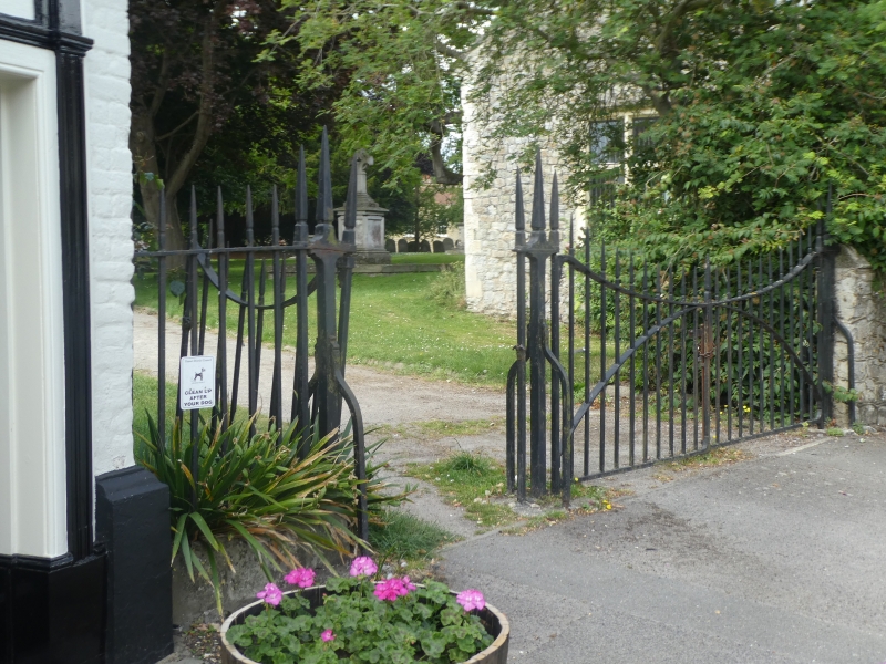
Latitude: 51.3308 / 51°19'51"N
Longitude: 1.3163 / 1°18'58"E
OS Eastings: 631117
OS Northings: 164304
OS Grid: TR311643
Mapcode National: GBR X0G.HM9
Mapcode Global: VHLGC.RTQ4
Plus Code: 9F3388J8+8G
Entry Name: Gate and Railings Adjoining and West of the White Horse
Listing Date: 7 October 1986
Grade: II
Source: Historic England
Source ID: 1223815
English Heritage Legacy ID: 419687
ID on this website: 101223815
Location: Durlock, Thanet, Kent, CT12
County: Kent
District: Thanet
Civil Parish: Minster
Built-Up Area: Minster (Thanet)
Traditional County: Kent
Lieutenancy Area (Ceremonial County): Kent
Tagged with: Gate Guard rail
MINSTER CHURCH STREET TR 3064-3164 (South Side) 5/21 Gate and railings adjoining and west of The White Horse GV II
Gates and rails. C18. Cast iron. Rail about 3 feet high, on rendered base for about 3 feet in length, these with free standing section to gate pier. Gate piers with 3 spiked principals to left, 2 to right hand pier. Spiked uprights to fence and double gates, with sweeping top rail and secondary rail curving up to meet at gate latch.
Listing NGR: TR3111764304
External links are from the relevant listing authority and, where applicable, Wikidata. Wikidata IDs may be related buildings as well as this specific building. If you want to add or update a link, you will need to do so by editing the Wikidata entry.


Other nearby listed buildings