Approximate Location Map
Large Map »
Latitude: 51.8087 / 51°48'31"N
Longitude: -1.6362 / 1°38'10"W
OS Eastings: 425181
OS Northings: 212288
OS Grid: SP251122
Mapcode National: GBR 5SW.F6G
Mapcode Global: VHBZS.LSDV
Plus Code: 9C3WR957+FG
Entry Name: Clement House
Listing Date: 11 March 1976
Grade: II
Source: Historic England
Source ID: 1223869
English Heritage Legacy ID: 419744
ID on this website: 101223869
Location: Burford, West Oxfordshire, OX18
County: Oxfordshire
District: West Oxfordshire
Civil Parish: Burford
Built-Up Area: Burford
Traditional County: Oxfordshire
Lieutenancy Area (Ceremonial County): Oxfordshire
Church of England Parish: Burford
Church of England Diocese: Oxford
Tagged with: House
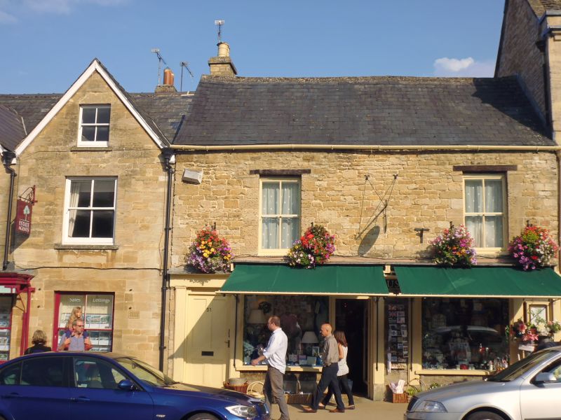
BURFORD AND UPTON HIGH STREET
AND SIGNET (East Side)
SP2512 (&d+) No 51 (Clement House)
7/64
11.3.76
GV II
House. Mid C19 front. Rubble with slate roof. 2 storeys; 2 windows,
wide paned sashes with timber lintels. 2 mid-C19 shops fronts with
pilaster strips, adapted, on ground floor.
Listing NGR: SP2518112288
External links are from the relevant listing authority and, where applicable, Wikidata. Wikidata IDs may be related buildings as well as this specific building. If you want to add or update a link, you will need to do so by editing the Wikidata entry.


Other nearby listed buildings
