Latitude: 51.2729 / 51°16'22"N
Longitude: 0.5214 / 0°31'17"E
OS Eastings: 575975
OS Northings: 155661
OS Grid: TQ759556
Mapcode National: GBR PR7.0NH
Mapcode Global: VHJMF.080J
Plus Code: 9F327GFC+5H
Entry Name: 74 AND 75, BANK STREET (See details for further address information)
Listing Date: 2 August 1974
Grade: II
Source: Historic England
Source ID: 1224407
English Heritage Legacy ID: 173356
ID on this website: 101224407
Location: Maidstone, Kent, ME14
County: Kent
District: Maidstone
Electoral Ward/Division: High Street
Parish: Non Civil Parish
Built-Up Area: Maidstone
Traditional County: Kent
Lieutenancy Area (Ceremonial County): Kent
Tagged with: Building
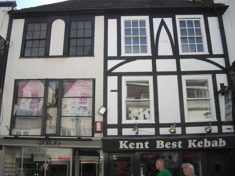
HIGH STREET
1.
5278
BANK STREET
(South-East Side)
Nos 74 & 75
TQ 7555 NE 1/281
II GV
2.
A timber-framed building altered. 3 storeys, No 75 now roughcast and No 74
plastered with applied timber-framing. Hipped old tiled roof. 2nd floor has
4 sashes in all with glazing bars intact. Modillion eaves cornice. No 75
has a later lst floor window and No 74 has 2 without glazing bars. Modern
shopfronts. Grade II for group value.
Nos 73 to 88 (consec) form a group.
Listing NGR: TQ7597455661
External links are from the relevant listing authority and, where applicable, Wikidata. Wikidata IDs may be related buildings as well as this specific building. If you want to add or update a link, you will need to do so by editing the Wikidata entry.


Other nearby listed buildings