Approximate Location Map
Large Map »
Latitude: 51.2731 / 51°16'22"N
Longitude: 0.5217 / 0°31'18"E
OS Eastings: 575996
OS Northings: 155676
OS Grid: TQ759556
Mapcode National: GBR PR7.0QM
Mapcode Global: VHJMF.085F
Plus Code: 9F327GFC+6M
Entry Name: 79-81, BANK STREET (See details for further address information)
Listing Date: 30 July 1951
Grade: II
Source: Historic England
Source ID: 1086356
English Heritage Legacy ID: 173359
ID on this website: 101086356
Location: Maidstone, Kent, ME14
County: Kent
District: Maidstone
Electoral Ward/Division: High Street
Parish: Non Civil Parish
Built-Up Area: Maidstone
Traditional County: Kent
Lieutenancy Area (Ceremonial County): Kent
Tagged with: Building
HIGH STREET
1.
5278
BANK STREET
(South-East Side)
Nos 79 to 81 (consec)
TQ 7555 NE 1/16
TQ 7655 NW 2/16 30.7.51.
II GV
2.
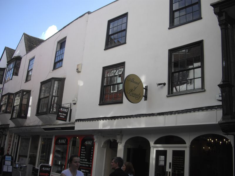
C18 fronts to timber-framed buildings retaining the overhang of the 1st floor.
3 storeys stuccoed. Parapet. 4 sashes with glazing bars intact on the 1st
and 2nd floors. Nos 80 and 81 have small bay windows on the 1st floor. Modern
shop fronts.
Nos 73 to 88 (consec) form a group.
Listing NGR: TQ7599455676
External links are from the relevant listing authority and, where applicable, Wikidata. Wikidata IDs may be related buildings as well as this specific building. If you want to add or update a link, you will need to do so by editing the Wikidata entry.


Other nearby listed buildings
