Latitude: 51.353 / 51°21'10"N
Longitude: 1.2546 / 1°15'16"E
OS Eastings: 626709
OS Northings: 166580
OS Grid: TR267665
Mapcode National: GBR VYW.00M
Mapcode Global: VHLGB.P8L3
Plus Code: 9F339733+6R
Entry Name: Pepper Alley
Listing Date: 25 June 1971
Last Amended: 7 October 1986
Grade: II
Source: Historic England
Source ID: 1225006
English Heritage Legacy ID: 420961
ID on this website: 101225006
Location: St Nicholas at Wade, Thanet, Kent, CT7
County: Kent
District: Thanet
Civil Parish: St. Nicholas at Wade
Built-Up Area: St Nicholas at Wade
Traditional County: Kent
Lieutenancy Area (Ceremonial County): Kent
Tagged with: Architectural structure
ST NICHOLAS AT WADE THE LENGTH TR 26 NE (south side) 1/95 Nos.1&2 Pepper Alley (formerly listed 25.6.71 under The Street, St Nicholas at Wade) GV II
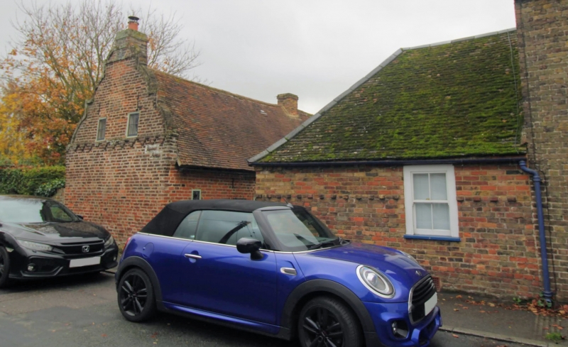
Cottage pair. Late C17. Red brick and plain tiled roof. One storey and attic on plinth. Roof with triple compass shaped gable, 1 raking dormer and stacks to end left, centre left and end right. Boarded door to left with 2 small sidelights and segmental headed horizontally sliding sash to right. Two segmental headed horizontally sliding sashes at end right with boarded door and flat hood between. Wall ties in left gable: I L. Brick bonded with alternating stretcher courses and stretcher with headers (found locally in and around Minster in Thanet).
Listing NGR: TR2670966580
External links are from the relevant listing authority and, where applicable, Wikidata. Wikidata IDs may be related buildings as well as this specific building. If you want to add or update a link, you will need to do so by editing the Wikidata entry.


Other nearby listed buildings